“I wonder if the snow loves the trees and fields, that it kisses them so gently? And then it covers them up snug, you know, with a white quilt; and perhaps it says, “Go to sleep, darlings, till the summer comes again.” ― Lewis Carroll, Alice’s Adventures in Wonderland
We are having a proper winter in New Hampshire this season. The cold is unrelenting and the snow consistent. It isn’t inclined to melt away when the days are frigid. Instead we have sublimation of the snowpack, and a sting on the skin. As we step into February, I write of the last day of January 2026, and a walk in the woods I’ll remember as particularly remarkable (so much so that I’m remarking on it).
Almost a week after the region’s big snow, I finally had some time available to head to the local conservation area for a walk in the woods on my snowshoes. I went with trepidation, for I know the damage that can happen to a trail after a week of people and their pets post-holing through deep snow. But the parking lot was surprisingly empty for a Saturday morning, and the trails themselves were relatively clean. Post-holed for sure, but it’s been so cold and the snow so fluffy that it wasn’t the icy hellscape I thought it might be.
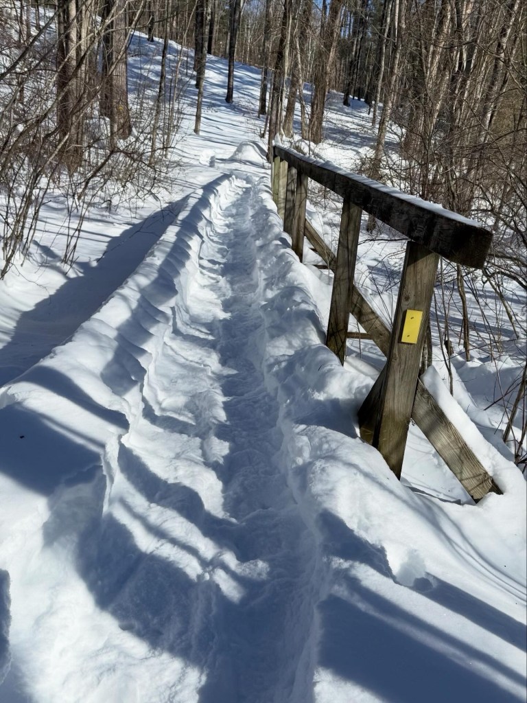
I still chose to break trail on pristine snow whenever the opportunity presented itself. Making a bee-line across steep terrain from one broken trail towards another. Some of the drifts were pretty deep, almost 4 feet of powder, but my snowshoes were up to the task. Thankfully, so was I!
Large portions of the conservation land’s trail network were completely unbroken. I smiled to myself at the lucky break and braced myself for the work ahead. Breaking trail on snowshoes is a great workout, and I’d gone out by myself with nobody to share the load. This is where being well-acquainted with working out comes in handy. I’m no Olympian, but I can break a trail for a few miles without passing out from the effort.
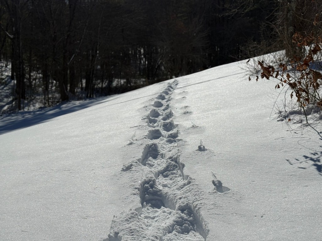
The larger trail network required an out and back over a bridge spanning wetland. On the way to it the bridge was untouched by anything but snow. On the return, I captured a picture of the trail I’d made on the out and back. It will be interesting to see what it looks like today, with a broken trail that others may have since walked.
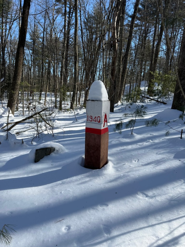
In one section, I revisited a town border marker that someone has since painted white with red lettering to make it more obvious to visitors. A is for Atkinson. There’s an H on the other side for Hampstead. Most of the trail network covers the latter town.
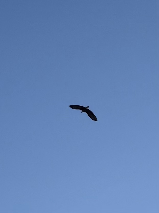
For all my time in nature on this snowshoe walk, I didn’t see much in the way of wildlife (It’s not like I’m sneaking up on anybody marching across the snow). Ironically, when I drove home afterwards, a neighbor excitedly told me he’d had three bald eagles in a tree in his yard not more than 30 minutes before. Now we’ve had a lot of wildlife moving through the neighborhood over the years, but none of us had ever seen a bald eagle, let alone three of them together. I’m sure that they’re hungry, and with the rivers frozen over they are scoping out the local valleys to expand their menu.
The odds were against seeing them still in the area, but I recruited the dog for a walk of the neighborhood to see if one would return. Sure enough, I was blessed with a fly-over by one of them. There’s no mistaking an eagle soaring over the landscape, and it was a thrill to see it. By the time I had my phone out to snap a picture it was already past me gliding towards open fields beyond the woods. It was a great way to cap a Saturday morning in snowy New Hampshire.