In Buffalo for work, I debated dancing with an elephant or walking in the footsteps of a ghost. With better planning I could have done both. They say we all have one life, and to make the most of the opportunities you’re presented with. I confess to not taking full advantage of that over the years. The way the day was shaping up, I had the opportunity to hit a couple of local points of interest while in the area. Or work a little more at my desk in the hotel. I know which I’d regret on my deathbed and chose wisely.
Niagara Falls is a well-known elephant that everyone should dance with at least once in their lives. I’ve danced with the falls on several occasions before. But I’d never gone there in winter. So I got up and out of the hotel early and drove out to Prospect Point at Niagara Falls State Park. I walked in with one of the park employees who was going to work. The park is open 24 hours a day but on a cold, wet morning in late November who the heck is going to go there pre-dawn? Only the security patrols know for sure. And in the Niagara Falls neighborhood, I’m sure they have some doozies. I’m probably on that list now myself.
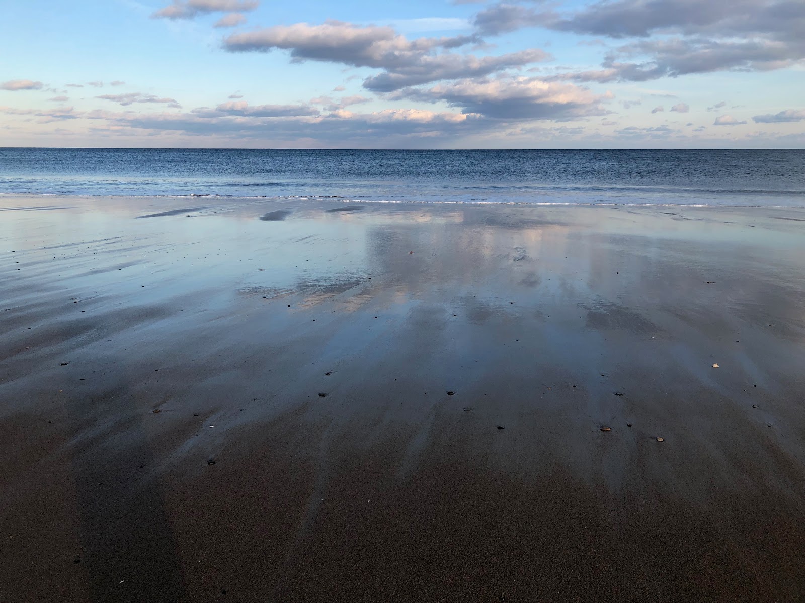
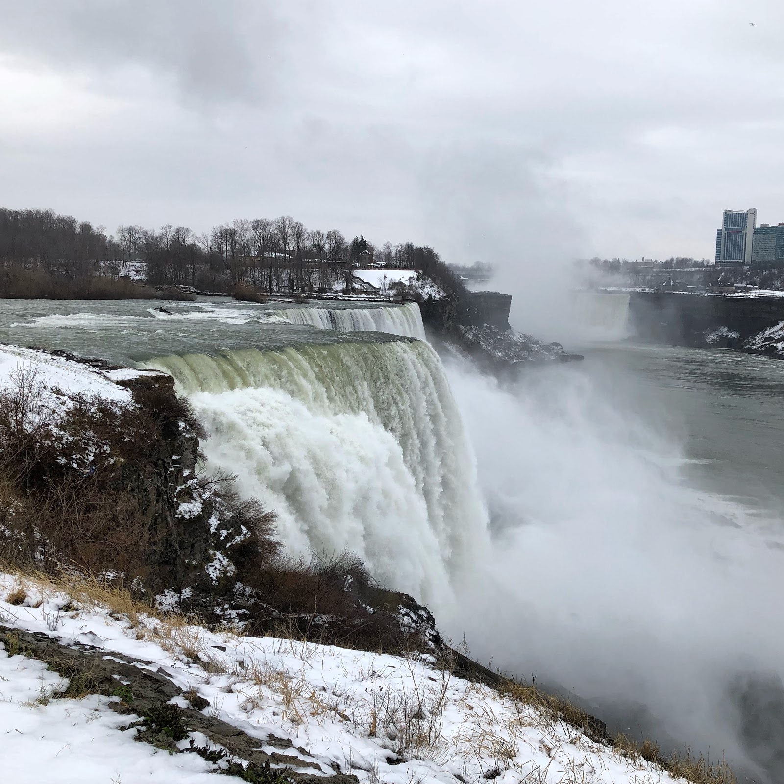
The view of the American Falls from Prospect Point is spectacular. This was the dance with the elephant that I’d had in mind when I debated the side trip the night before. With a distinct chill in the air, the mist rising from the crashing falls was beautiful. This view alone was worth the 20 minute drive out from the hotel. And perhaps I should have stopped on this high note.

I should mention that while I was in the car, I’d contemplated putting on either the boots I’d brought with me or the running shoes that I had for the hotel treadmill I ignored. I also scrutinized the winter hat and gloves that I’d brought for this weather. In a move of questionable, Darwinian logic, I chose to just keep my dress shoes on and skip the hat and gloves. After all, I was only going to be there for a short time before I went to my first meeting of the day, so why take the two minutes to change shoes? And why get hat head before your meeting? This is the very logic that precedes business tourist tragedies.
My first clue that my logic was bad was when I hit a patch of ice walking to view the falls at the American Falls viewing area. The park service did a decent job of clearing and salting the walkways, but things melt overnight and refreeze, and that’s exactly what I found with my leather soled dress black shoes. But I pressed on and had a nice photo of the falls to post on Instagram. Mission accomplished? For the responsible, reasoned and experienced traveller for sure. In this moment I omitted responsibility and reason and thought to myself, if you got this spectacular picture at Prospect Point of the American Falls, imagine how good a photo you might get over at Terrapin Point of the Horseshoe Falls?
Looking over at Goat Island and then down at my footwear, I had another moment of false hope for my future where I thought that no, this wouldn’t be a good life choice. Go back to the car, drive over to Goat Island, put on better footwear and then if you’re still insistent go see the Horseshoe Falls. Better yet, go get a coffee and celebrate having this small victory.
Instead I pressed on, shuffling across the frosted sheet metal of the pedestrian bridge, hands pressed deep in my coat pockets against the cold, and over to the very quiet Goat Island. The few tourists I did see were dressed in winter-appropriate clothes and footwear, and were certainly wondering who the idiot was dressed for a sales meeting shuffling about on a cold morning in Niagara Falls. I was wondering that myself. But since I’d come all this way, I was going to get that picture at Terrapin Point, damn it, as a reward for my stubborn persistence.

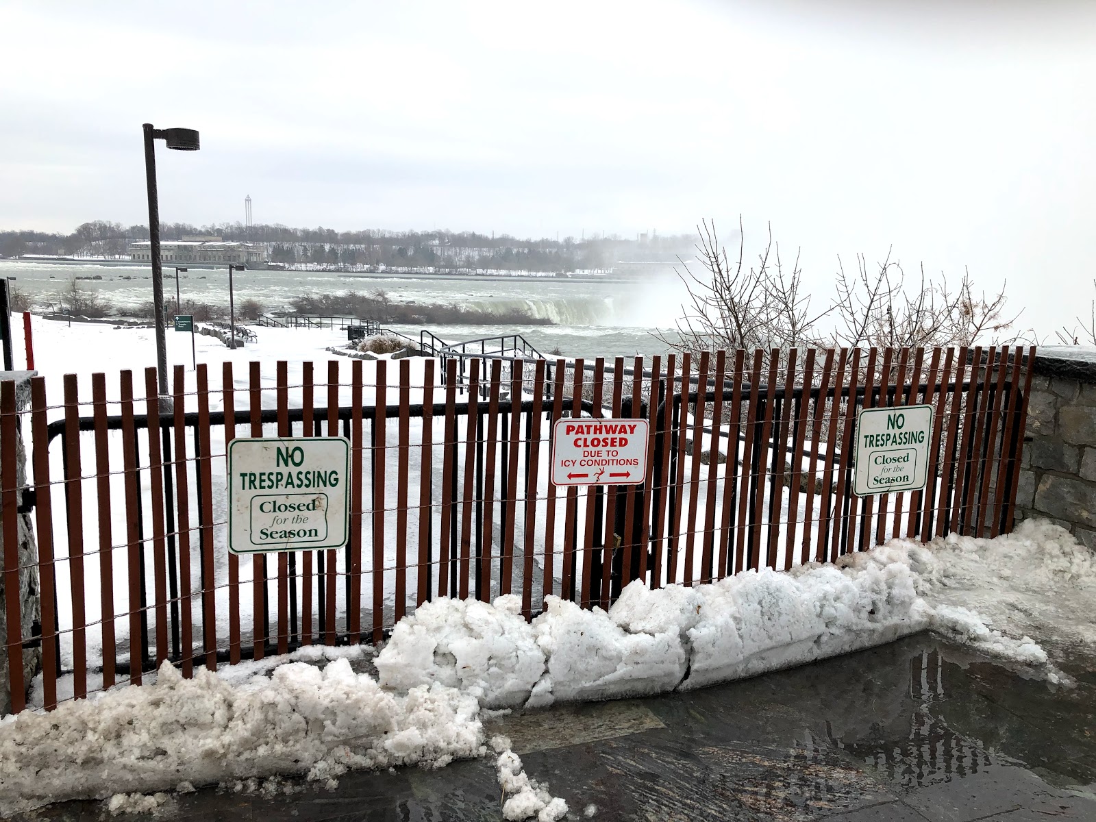
In the back of my mind from the moment I thought up this idea the night before, across the frozen tundra and the treacherous white water of the American Rapids, and then shuffling along the icy walkways where the mist from the falls froze on the paved paths, that there’s no way that the park service would have Terrapin Point open. It would be way too dangerous having tourists on a sheet of ice inches away from the falls. People die in summertime when they lean over too far to take a picture. In winter? Forget it. Self-selection is a great theory but who’s going to clean up the mess? No chance at all it’s going to be open. And sure enough…
I laughed to myself, or rather at myself and shuffled the 20 minutes back to where I parked my car where I toweled off my black dress shoes and cranked the heat to the highest setting. I’d survived my flawed logic and can laugh at myself, but I know I was pretty lucky for a dumb ass business traveller.
This ill-fated side trip to Terrapin Point ate into the available time I had for my dance with a ghost. So saved for another day is a stop at the plaque memorializing the spot where President McKinley was assassinated at the Pan-American Exposition on September 6, 1901. I’d come across the McKinley Memorial in Canton, Ohio several years ago and was struck by his story. So learning about this small memorial in Buffalo was almost as alluring to me as going to see the falls.
The Pan-American Expo was a big deal at the time, and there was a big fight for it between Niagara Falls and Buffalo. Due to better transportation options in Buffalo and maybe some political muscling, Buffalo won out. The Exposition showcased technology like X-Rays and electric lights, things that they neglected to use to save the President when he was shot by an anarchist at the Temple of Music.
Like most expos, the buildings were torn down long ago, and that site is now a neighborhood with a small median of grass where the memorial is. It’s nothing like the spectacular waterfalls I saw. But there’s a whisper of history there that I’d like to feel on another day. How many such memorials do we breeze by, not realizing the stories and the lives of those that came before us? I’m not a “ghost” kind of guy, but I like to walk in the footsteps of history and better understand those who stood there before me. Capra on Wednesday on Bridge Street in Seneca Falls, McKinley on Fordham Street in Buffalo was to be Thursday. But alas, adventure is time-consuming and my career called me back to reality. Perhaps another day.