Tag: Lake George

  • Narraganset Bay to Lake Champlain

    I drove the 310 miles between Newport, Rhode Island and Burlington, Vermont in two legs, with a brief nap at home in between. Heavy rain and a relentless, brilliant lightning display will be what I’ll remember about the first leg, and the mist covered Green Mountains of Vermont surely will be the thing I remember about the second. It occurred to me that this journey 250 years ago would have been very different indeed. Instead of driving up I-93 to I-89, my options would have been to sail south to the Hudson River for an arduous journey upriver, a risky portage to Lake George, and another between Lake George and Lake Champlain or alternatively taking the northern route up to the St Lawrence River over to Lake Champlain. Either proposition was shorter and safer than the overland I did would have been.

    Sometimes we take for granted just how far we’ve come in such a short amount of time. I’ve come to appreciate our collective technological advancement more through reading history and traveling from place to place. Communication has advanced along with the roads, and now I have the ability to talk to anyone in the world in seconds. How awed King George would have been, and what a difference good roads or communications would have made in the wars fought along the shores of Newport and Lake Champlain. That route from there to here seems a lot further given the hindsight of history.

  • From Bloody Pond to Winter Street

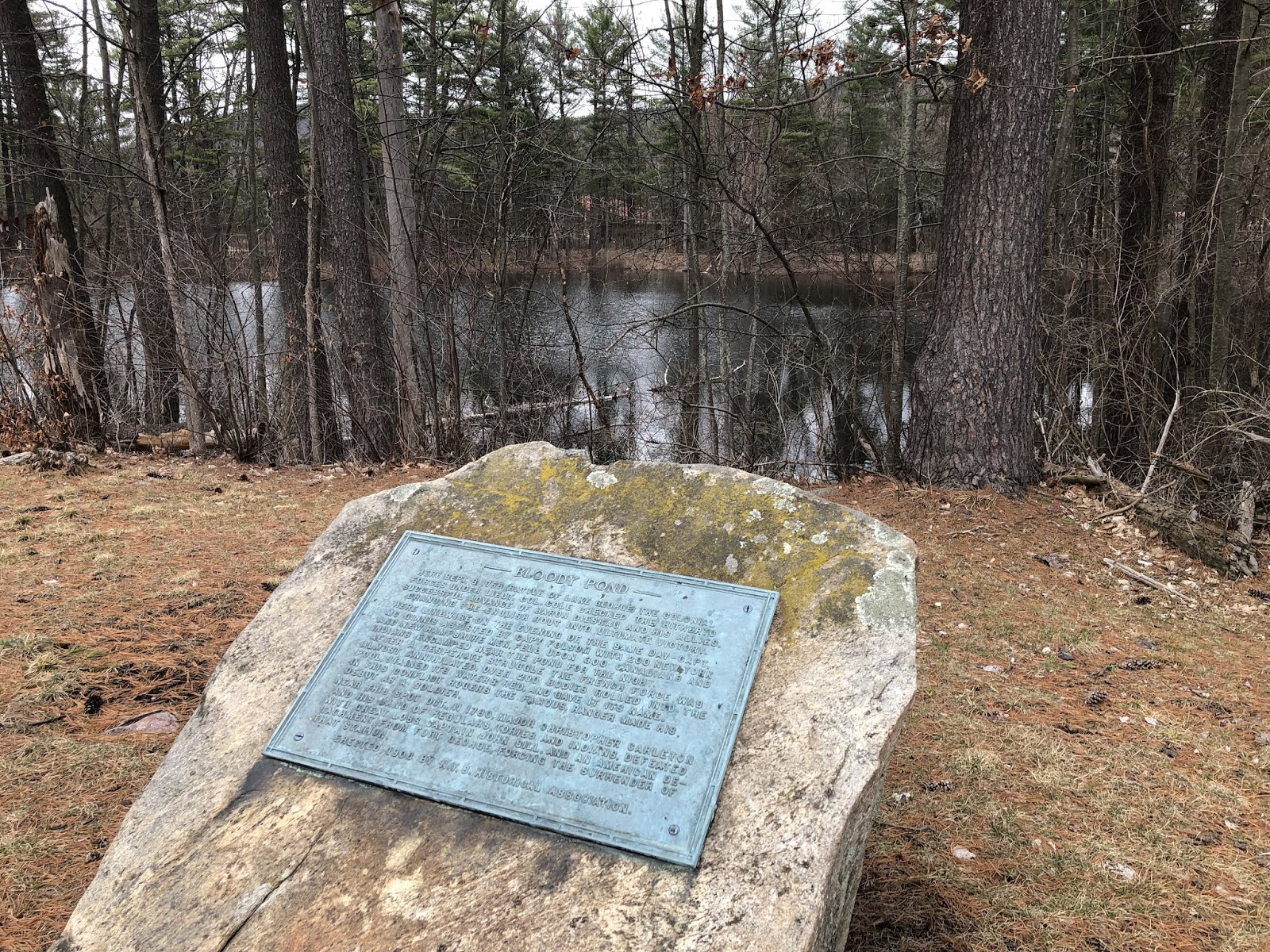
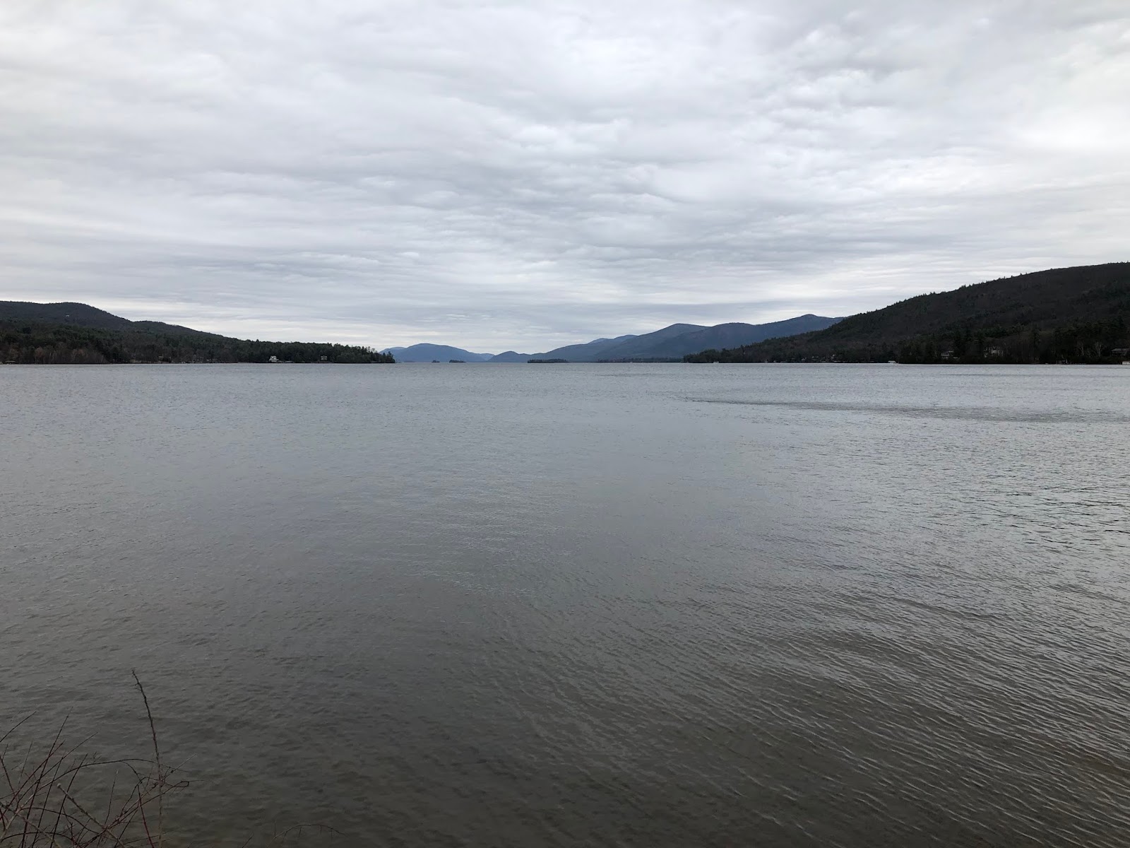
    During the French and Indian War the pristine Lake George saw some horrific battles for control of the lake.  The British and French continued attempts to push each other out of the region with force.  The Battle of Lake George in 1755, the siege on Fort William Henry in 1757, the Battle on Snowshoes in 1758 and countless skirmishes in between let to high body counts on both sides.  One relatively small battle in 1755 illustrates just how bloody the fighting was.

    The New Hampshire Provincial Regiment, consisting of a company of men led by Colonel Nathaniel Folsom (including Robert Rogers in his first battle) plus another 40 New York Provincials under Capt. McGennis came across the baggage and ammunition that the French had left protected with a guard.  They quickly overwhelmed the guard and waited for the larger force of French Canadians and their Indian allies to return.  Late in the afternoon a combined force of roughly 300 returned to the camp and walked into a field of fire from the New Hampshire and New York milita.  In this battle over two hundred men were killed, and subsequently rolled into the pond, which turned red as the blood of the French, Canadians, Native Americans, and colonial militia mixed together in the water.  Enemies returning to the earth together.

    McGennis didn’t survive the battle.  Folsom did, and would go on to participate in other battles of the French and Indian War, and then took up arms in the Revolutionary War.  Folsom and John Stark were both leaders in the New Hampshire Militia.  Folsom  was a delegate representing New Hampshire in the the Provincial Congress and ultimately the Continental Congress.  By all accounts I’ve read he led a life of service to New Hampshire and the country.

    I visited the Winter Street Cemetery to visit Major General Nathaniel Folsom.  I wasn’t sure where his gravestone was when I got there, but looking around I noticed that there weren’t that many that had American flags posted next to them so I used that as my starting point.  I walked around that cemetery for 40 minutes reading each gravestone.  Most of the Revolutionary War veterans had a similar shape and size, with the unique badge carved in the front.  And yet I couldn’t find Folsom’s gravestone.  Folsom was a hero of two wars for the American Colonies, he must have a flag, right?  No flag.  Perhaps it blew over in the wind, or someone took it, or someone forgot to place one next to his gravestone to honor him.  Who knows?

    My time was limited, and I still hadn’t found Nathaniel Folsom.  But I did find the graves of his fellow Revolutionary War veterans, and read the family names of the people who were his neighbors and friends.  And finally it was time to go, and as I stood near the gate I thought I’d just walk down the middle one last time and try an area I hadn’t recalled walking past in my search… and there he was.  His was quite literally one of the very last gravestones I came across.  It’s almost like he wanted me to pay my respects to the rest of the people in the cemetery before coming to see him.

    Like other roadside monuments, the small memorial on Route 9 in Lake George, New York, crowded by motels, auto parts stores and a sushi restaurant, called out to me as I drove by.  It led me to read more about Nathaniel Folsom and eventually to my visit to his home town and final resting place.  For all that he did for his state and his country, his grave is modest – no different than those of other soldiers from the Revolutionary War buried nearby.  If these two modest monuments bookend his life, they served their purpose by helping me get acquainted with this gentleman from Exeter.

  • Lake George, 1757

    When you stand along the shore of Lake George and look to the northeast on a quiet April day as I did recently, you’re struck by how beautiful the lake is.  Lake George still looks pristine, surrounded by conservation land and state parks.  The Adirondacks rise up in the distance.  Lake George, like the finger lakes to the west and Lake Champlain to the north, is a long and sometimes narrow body of water, very much like a river.  It was the primary transportation channel for countless generations of Native Americans and the French and English settlers who came after them.  A relatively short portage to the Hudson River to the south and Lake Champlain to the north made this body of water a critical link in the chain.

    There were several battles and skirmishes on this lake in the early colonial period, but two stand out during the French and Indian War.  Just beyond the farthest point of the lake you can see in this picture the lake jogs eastward and narrows to a point of land where it turns northward again.  This spot is called Sabbath Day Point, and it was here on July 23, 1757 that 350 New Jersey provincial soldiers (the “New Jersey Blues”) on a reconnaissance mission were surprised by hundreds of Indians who paddled out and attacked them in their boats.

    “The whoops of our Indians impressed them with such terror, that they made but a feeble resistance; two barges only escaped; all the others were captured or sunk. I have 160 prisoners here, 5 of whom are officers. About 160 men have been killed or drowned.” — M. de Montcalm to M. de Vaudreuil. 

    On August 3, 1757 this pristine view of the lake terrified the troops stationed at Fort William Henry, as hundreds of bateau boats and canoes filled the lake forming a massive fleet rowing and paddling right towards where I was standing when I took this picture.  They laid siege on the fort for six days until they forced the British to surrender as their cannon began to overheat and fail and the French artillery breached the walls.  During the surrender a horrific massacre ensued as the Indians descended on the men, women and children surrendering to them looking for their plunder and scalps.  That’s a story for another day, but there’s an excellent account of it from The Lake George Examiner worth reading.

    I’ve looked out on this view of Lake George a few times over the years and it always fills me with awe at how beautiful the lake is.  It’s hard to imagine the horror experienced by those soldiers in the summer of 1757 close to where I’d been standing.  The Indians who committed the massacre – or their tribes – would suffer their own horrors in the years to come.  There’s an inevitable friction that comes with expansion, and as Native Americans, the French, English and others wrestled for control of this continent violence would continue to escalate.  This beautiful waterway, as with so many other beautiful places around the world, was once the center of violent conflict.  And 1757 was a particularly dark time for this lovely place.


  • What’s Up is Down

    What’s Up is Down

    While it makes sense that to go up a river or a lake that is fed by a stream or river, intuitively when you live in the Northeast you think of going up the river as going north or west.  That’s because the majority of rivers that flow to the sea do so in a southbound or eastbound way.  To go “up the river” to SingSing was to go up the Hudson River from New York City to Ossining, New York.  But there are several examples in the region where the opposite happens.  

    Watershed maps indicate several rivers that flow north to the St Lawrence River.  These include the Chaudière River (Rivière Chaudière) and the Richelieu River, which is fed from Lake Champlain and Lake George through a series of smaller rivers.  Because these two lakes flow north to the St Lawrence, going “up the lake” means going south, and going “down the lake” north.  This upside down world of navigation makes perfect sense when you think about water flowing down, but is topsy-turvy when you think about north-south.
    It’s a good reminder that your way of thinking, based on your experiences, isn’t necessarily correct.  Next time I think I’ve got something all figured out I’ll reflect on nature’s reminder that what’s up can indeed be down.  That’s a good reminder for all of us.
  • The Great Carrying Place

    There’s an almost unbroken stretch of navigable water from New York City up the Hudson to Lake George to Lake Champlain to the St. Lawrence Seaway, which in turn leads back to the Atlantic Ocean or deep into the interior of North America to the Great Lakes.  The “almost” part is a couple of stretches of land that must be portaged where the La Chute River is unnavigable.  This two mile stretch of land between Lake George and Lake Champlain is the place the Native Americans called “the great carrying place”.  There are other portages with the same name, notably a stretch of trail in Maine that Benedict Arnold used to invade Quebec, but this stretch in New York is arguably much more strategic.

    In the years before and during the French and Indian War this was one of the most strategically important and thus heavily contested patch of wilderness in North America.  Navigable water was the most efficient and fastest way to travel at the time, and aside from this stretch of land navigable water was close to unbroken.  During the Revolutionary War this place was the site of significant naval and land battles led by Benedict Arnold.

    I’ve been to Glens Falls and Saratoga many times.  I’ve been to Lake George once or twice.  And I’ve been on and most of the way around Lake Champlain.  But I’ve never viewed the region with the educated eyes of a historian.  It’s not that I didn’t know the rough history of the region, it’s that I was apathetic towards it.  I’m not longer apathetic.  The next time I make my way through the region I’m going to spend a little time immersing myself in the history of the region.  Fort Ticonderoga, Mt. Defiance, Saratoga and so much epic history happened right in this area.  I can’t very well ignore it now can I?