Tag: Massachusetts

  • State Change

    Everything has changed. Well almost everything. New sounds; I’ve never heard that dog bark before. The rumble and back-up beeping of construction equipment is new too. Seems to be road work happening at the top of the hill. A young squirrel is working the oak tree in the neighbors’ yard and there’s a constant drip of acorns plummeting through the leaves and thumping onto the ground.  Seems early for the dropping acorns but the squirrel seems to know more than I do about the matter.

    Some birds remain, like the brown thrasher I spent all summer trying to figure out. But the bluebirds are gone, and with them the feeling of early summer. Some new birds sing but I can’t place them. Migrating from someplace to another destination, with a quick stop in my neighborhood. I don’t know birds like I know some other things. But the more I know about anything the less I seem to know about that very thing.  Such is the way of the world.  I’ve learned to respect the journey of self-education, and hate myself for falling into the trap of thinking I know everything about anything.  Worse still is acting so.  Better to be open to the world around you; a sponge not a bullhorn.  There are far too many bullhorns already.

    Autumn is in the air. I felt it on Buzzards Bay as the winds shifted. This is first day of school bus stop air, and we aren’t yet halfway through August. And here in New Hampshire with the cool, humid air and white noise background buzz of crickets singing their late summer song.  Getting outside away from media opens the senses and the mind alike.  But other changes are in the air. A quarter of the family flying to London soon state change kind of air.  Another quarter entering senior year in college kind of air.  And what are we doing in this big house with all this stuff kind of air.

    Gone for a week and everything is different.  It would have been different if I’d been here too, but the daily gradual change isn’t noticed the way it is when you step away for a bit. Everything changes constantly. And so do I. A little for the better in some ways, a little for the worse in others, but generally more growth than decline. We all know what the ultimate end game is, but that doesn’t mean you have to live like you’re dead already. I know too many people who live in virtual bubble wrap, watching the world pass them by. I want to shake them loose, and whatever cobwebs I’ve grown myself, and shout “Embrace the changes; there’s magic in the air if you’ll only feel it!”

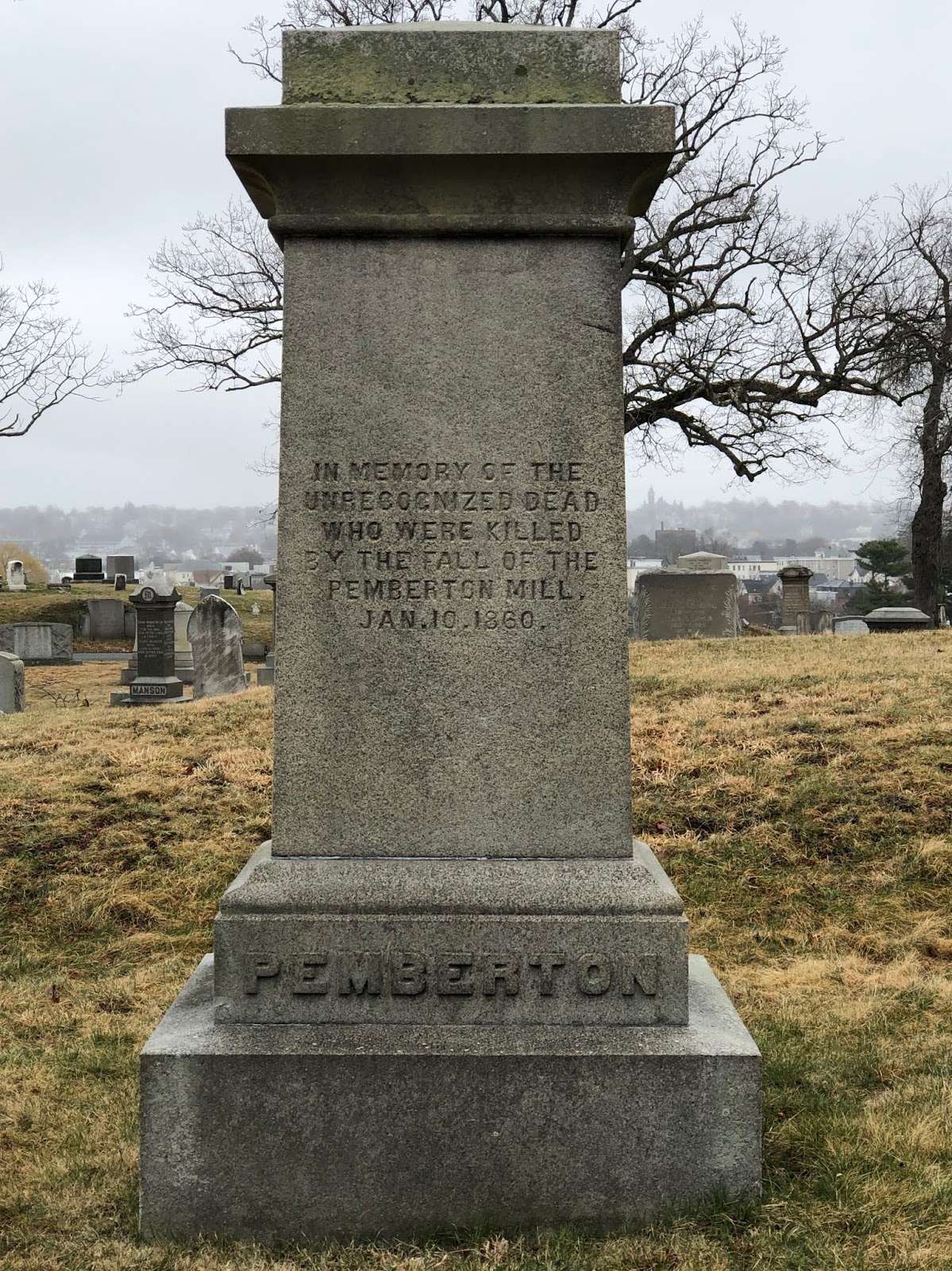
    I have a drive to Connecticut to get to.  That drive brings me from New Hampshire through Massachusetts to Connecticut, then the reverse this evening for the drive back.  Four hour round trip drive time, and more like seven hours with meetings thrown in the mix.  I could probably stay overnight in Connecticut, but there are compelling reasons to get back home this week, and so I’ll do the round trip instead.  My state change is both literal and figurative today.  But I do enjoy the journey.

  • From Pemaquid to Andover: A Tale of Abenaki Revenge

    On February 22, 1698 a group of Abenaki warriors raided Andover, Massachusetts and killed five people and two more (Haynes and Ladd) in Haverhill.  Raids like this were somewhat common in the Merrimack River Valley at that time, as it was the frontier and friction between settlers encroaching on the lands of Native Americans who had lived there for generations was an unpleasant reality for everyone living in this area.  What was particularly interesting about this raid was who they killed, which leads to why they chose this place for a raid in the first place.

    Two years earlier at Fort William Henry in Pemaquid, Maine, Captain Pasco Chubb commanded a garrison of 60 soldiers who were stationed here, tasked with defending this relatively new stone fort from the French and Abenaki who would prefer to have them elsewhere. This site, on a point of land jutting out into Johns Bay at the mouth of the Pemaquid River, wasn’t particularly strategic, but it represented what was meant to be a permanent foothold on the coast of Maine (then part of Massachusetts) and the northernmost settlement by the English. Fort George, A wooden stockade on this spot hadn’t fared well just a few years earlier, so in reconstructing the fort the British stepped in and built it of stone and armed it with 15-20 cannon. It was completed in 1692 and held by a garrison of 60-90 men.

    There were at least three critical weaknesses with Fort William Henry. First, it was isolated and any reasonable hope for reinforcements was small. Second, the small stone and lime walls were not particularly strong, making them vulnerable to the cannon the French would bring. And third, and an unforgivable mistake given the other vulnerabilities, the supply of drinking water was outside the fort walls! So a siege of any length would prove highly effective as water in the fort was depleted.

    Ongoing tensions with the French and Native American population almost guaranteed that a siege would eventually take place.  And Fort William Henry was indeed besieged on August 14, 1696 by 100 French and 400 Abenaki. Prior to the siege, two Abenaki chiefs named Edgeremet and Abinquid went to meet with Captain Chubb under a white flag to inquire about some fellow Abenaki captured by Chubb’s predecessor and shipped to Boston. The goal was a prisoner exchange with the British.  Chubb and his men raised their guns and shot Edgeremet and two of his sons. Depending on the account you read, Chief Abinquid may have escaped. Either way this act of cowardly violence against Abenaki tribal leaders under a white flag enraged the besiegers. They wouldn’t forget Chubb and the British betrayal.

    The Abenaki wrote a letter that demonstrated their rage and feelings of betrayal.  It would set the table for later violence against settlers:

    “Lord who write at to me, listen and understand what I am about to say, аnd write, to you. Thou wilt easily recognize my words, and why wilt them not recognize them. It is thou (so to express myself) that furnishest them to me. Writing with too much haughtiness, thou obligest me to reply to thee in the same style. Now, then, listen to the truths I am about to tell thee of thyself; of thee, who dost not speak the truth when thou sayeth that I kill thee cruelly. I never exercise any cruelty in killing thee, [a*I kill thee] only with hatchet blows and musket shots. Thy heart must have been еvеr addicted to wickedness and deceit. No other proof is necessary than the acts last autumn at Saco and Pemkuit, taking аnd detaining those who were going to obtain news from thee. Never in the universal world has it been seen, never has it been related of a man being taken prisoner who bears a flag [of truce] and goes to parley on public business. This, however, is what thou hast done; in truth, thou bait spoiled the subject of discussion. Thou hast covered it with blood; as for me, I could never resolve to act in that manner, for therein I have even an extreme horror of thy unparalleled treachery. How then dost thou expect that we would talk. What thou sayest I retort on thyself. There, repent and repair the grave fault thou hast committed; seize those who killed me at Saco, and made me prisoner at Pemkuit. I will do the like by thee. I will bring thee those who killed thee when I shall be able to find them. Fail not to do what I require of thee; of this, I say, who killest me without cause; who takest me prisoner when I am off my guard. – Abenaki letter, written by French missionary brothers Vincent and James Bigot, in response to the treachery at Pemaquid

    The French weren’t as surprised, writing in an account of the events that day that “It is to be hoped that the Abenakis will not place any confidence hereafter in English promises.”  

    The English were disgusted with Chubb for quickly surrendering the fort and fleeing back to Boston.  He was thrown in jail for months when he was set free, and only freed when he wrote a petition to the Court.  In it he wrote the following:

    “And whereas ye petition is a very poore man, having a wife and children to look after with by reason of his confines & poverty are reduced to a meane and necesstous condition, having not wherewith all either to defray his prison necessary charges or to relieve his indigent family…”

    Chubb would indeed be released from jail and return to Andover to be with his wife and child.  It was there that a party of 30 Abenaki warriors led by Chief Escumbuit from Big Island Pond would become reacquainted with Pasco Chubb, killing his wife and child, and paying extra attention on Chubb, shooting him several times to ensure he was dead.  Sweet revenge, perhaps, but with the loss of innocents as well.  Chubb has largely been forgotten in the early colonial history of America, and when his name is mentioned it’s appropriately with distain.


  • Where the Narrows Open Out

    Looking at John Sellers 1675 “Mapp of New England” I’m drawn to the place names on Cape Cod. “Yermoth“, Sandwich and Pocasset on the Cape, and the islands of “Martina Vineyard” and “Nantuket“. As with the entire map things are way out of scale, but still a fascinating snapshot of place in 1675 Cape Cod.  The other unique thing about Sellers’ map is that he turns New England on its side, offering a new perspective on the familiar shapes.

    The Pocasset Wampanoag were no strangers to Buzzards Bay, but they lived in the area that is now Tiverton, Rhode Island up to Fall River, Massachusetts and surrounding towns. If a place were going to be named Pocasset wouldn’t it be Tiverton or Fairhaven or some other place on that side of the bay? So how did this little corner of Cape Cod become known as Pocasset?

    The answer might lie in the word itself. “Pocasset” and some similar Algonquin names like “Pochassuck” and “Paugusset” all mean “the place where the narrows open out”. And that certainly applies to this part of Buzzards Bay. For the English settlers choosing Pocasset was likely easier than Pochassuck.  I can imagine the middle school jokes at neighboring towns if they’d gone that route.

    This place was likely visited by the Pocasset often as they traded with the Pilgrims at the Aptucxet Trading Post nearby. In talking about the land and the bay around them it’s probable that’s how the area was described as the bay opens up right after the point of Wings Neck. On the map Pocasset encompasses what is now Falmouth. Given the scale of the map it could be a minor point, or perhaps the entire stretch from Wings Neck to Woods Hole was considered the place where the narrows open out.

    That description fits the mind as well. Looking at old maps, reading books, and traveling to new places opens up my own once narrower mind. I break free of the daily routine and see things in a new way. So having a home away from home in Pocasset is more appropriate than I first thought.

  • Talking Turkey

    This morning I went for a 3 1/2 mile walk and came across a large tom turkey standing on the side of the road. A little later in my walk I saw another turkey, this time a hen, about twenty feet up in a tree. Two turkeys in 3 1/2 miles isn’t exactly extraordinary nowadays in New England, but I was on the Cape and you don’t think of turkeys and Cape Cod. But like everywhere else in New England the turkey population has exploded.

    When I was a kid running around in the woods of various towns in Middlesex County, Massachusetts I never saw a wild turkey. The first wild turkeys I ever saw were in South Kent, Connecticut in 1993. I remember it because it was a unique experience at the time. But Litchfield County is where you might expect to see wild turkey. It’s also where I saw my first coyote in the wild. Now you can see turkey almost anywhere.

    This exponential turkey population growth took place while we (most of us anyway) weren’t paying attention. Back in maybe 2007-2008 I recall seeing a few here and there but it was still a novel experience. Today in Southern New Hampshire it’s novel if I go a day without seeing or hearing one. There are an estimated 40,000+ turkey in New Hampshire today, and an estimated 200,000+ in New England.

    It wasn’t always this way. When Europeans first settled in New England they started clearing the land for farms. This destroyed the habitat of the wild animals that lived there, and those who didn’t die out from lack of habitat were eliminated through hunting. Turkey, deer, pigeons, wolves, bear, and countless other animals suffered the same fate. By 1850 turkey were largely extinct in New England.

    Efforts to re-introduce turkeys began in the 1930’s, first with releasing domesticated turkey into the wild. When that failed wild turkey were caught in Upstate New York and released in New England states. Over time those turkey reproduced and the population growth began to accelerate. One Tom can mate with many hens, which can hatch 6-12 eggs. With few predators it’s easy to see why the population exploded. Today they’re seemingly everywhere, including a little peninsula jutting out into Buzzards Bay.

  • The Bread and Roses Strike

    Lawrence, Massachusetts was the epicenter of two significant events in the history of industrial labor.  The first was the Pemberton Mill collapse, which I wrote about yesterday.  The second was the Bread and Roses Strike in 1912.  The strike began when mill workers realized that the mill owners chose to pay them two hours less in wages in reaction to a law passed in Massachusetts requiring women to work a maximum of 54 hours instead of 56 hours.  The mill owners weren’t exactly looking out for the welfare of the immigrants who worked in their mills, and took the cold calculation that if someone was working 54 hours they should be payed for 54 hours, not more.

    On January 11th the workers at the Everett Mills found that their wages were reduced and walked out, beginning the strike.  The next day the Washington Mill discovered their wages were reduced and followed suit.  Everntually upwards of 25,000 mill workers were on strike.  Police and the Massachusetts National Guard were brought in to “keep the peace” and instead poured gas on the fire as violence escalated.  One young woman named Anna LoPizzo was killed and instead of prosecuting the person that shot her the union organizers were framed for murder.

    As the strike continued for weeks families started sending their children on the train to the homes of sympathizers.  When another group of children were gathered together to be sent to more homes, the mill owners and police tried to prevent it.  This led to national attention on the working conditions that the mill workers were living with.  Eventually the mill owners agreed to a 5% raise to end the strike but tensions remained high.  One immigrant was beaten to death for wearing a pro-union pin.

    Over time the higher wages of workers in the mills prompted a shift in manufacturing of textiles, shoes and other items first to the south and eventually overseas.  The horrific working conditions that the Lawrence mill workers labored in shifted to these other places too.  When I hear about sweat shops in China or other places I can’t help but think about the original sweat shops along the banks of the Merrimack River.  The mills didn’t start this way, but over time the plight of the workers degraded  as the greed of the mill owners increased.  Now and then it’s good to look back on the history of the Industrial Revolution to understand why labor laws have evolved the way they have.

  • The Pemberton Mill Disaster

    On a quiet hill overlooking the City of Lawrence, Massachusetts is a monument memorializing the 145 mill workers killed on January 10th, 1860 when the Pemberton Mill collapsed.  Another 166 were injured.  Many victims were women and children.  As recent immigrants to America, the victims were buried at Bellevue Cemetery and this simple monument marks time serving as a reminder of the souls who perished that day.

    The Pemberton Mill disaster remains one of the worst industrial accidents in history.  If it were to happen today the mill owners would be imprisoned for criminal negligence.  The mill was built by the Essex Company in 1853 and was sold at a loss to George Howe and David Nevins, Sr. four years later during an economic downturn.  Howe and Nevins jammed more machinery into the building to make it more profitable.  This proved disastrous as three years later the building collapsed on itself with 800 mill workers inside.

    Immediately after the collapse rescuers converged on the pile of rubble to try to dig victims out.  Sometime during the rescue a lantern caused a fire that quickly grew to an uncontrollable inferno as oil-soaked wooden beams became tinder.  Rescuers could hear dozens of people screaming in terror as the flames raced through the rubble, eventually extinguishing the voices one by one.

    This is one of the most horrific stories I’ve ever read about, and it happened along the banks of the Merrimack River in Lawrence.  I’ve heard about the Pemberton Mill disaster, but I never really knew the extent of the tragedy.  For the young mill workers hoping to earn an honest wage in America, this was a brutally cruel end to their hopes and dreams.

    David Nevins, Sr. lived a long life, becoming a wealthy and generous resident of Methuen, Massachusetts.  The library in town is named after him.  Howe lived a long life too, but seems to have been less generous with his money.  The names of the workers who perished in the mill are long forgotten by history.  But their final moments serve as a stark reminder of what can happen when you stretch the limits of safety in the workplace.


  • The Old Worthen

    The oldest bar in Lowell, Massachusetts is today called The Worthen House.  Back when I was in college it was called The Old Worthen, and that’s still how I like to remember it.  If you walk into the place today you’ll find tables and a long bar that runs front to back.  The bar is essentially the same, but the tables were an addition after a fire gutted the old place.

    They say that Edgar Allen Poe frequented the place and wrote at least some of The Raven here.  More recently, Jack Kerouac and Allan Ginsberg drank at the Old Worthen.  That’s all fine and good, and as a history buff I appreciate those who came before me, but for me the Worthen was our college bar.  I spent my formative drinking years at The Old Worthen, and those memories are locked in my brain more than any class I took in college.

    Taking nothing away from the current place, back in the mid-1980’s The Old Worthen was a bit of a dump.  Wooden booths were jammed with hearty drinkers.  If you asked the bartender they’d give you a knife to carve your name into the walls.  We put away plenty of pitchers of cheap beer back in our day.

    The Old Worthen had a juke box.  For the life of me I can’t remember how many songs that juke box had, but there were five that always seemed to be playing.  My Way by Frank Sinatra, Mercedes Benz by Janis Joplin, Crazy by Patsy Cline, Tainted Love by Soft Cell and the hairspray rock anthem for somebody, Here I Go Again by Whitesnake.  That’s an eclectic mix of songs if I ever saw one.   The songs that were playing were usually determined by which table had the most quarters.  When we ran out of quarters somebody would jump in with hairspray rock.

    They say there’s a ghost on the second floor of the place.  I never saw a ghost in all the time I spent in that building, but then I never did get up to the second floor.  I like to dance with ghosts, as I’ve written about before.  But for me that doesn’t mean some spirit moving the plates around, it’s looking up at the leather belt driven ceiling fans and knowing I was looking at exactly the same thing that Jack and Allan were looking at 30 years before me.  A part of me lives on in the Worthen, as it does for thousands of others who walked through that front door.

    I’ve been back to the Worthen a couple of times over the years since college, but my time there is done.  The Worthen House belongs to the next generation of drinkers.  And just as the experience I had in the 80’s was different from the experience Kerouac had in the 50’s and Poe had in the mid-1840’s when he was living on the second floor, so too the experience is likely different for the generations that have come after me.  But I’m happy that it keeps on going year after year.


  • Mystery Hill

    I live roughly a mile and a half from a place called America’s Stonehenge.  It’s also known as Mystery Hill, and I like that name a bit more because it infers that there’s much about the site that is unknown.

    Here’s a great description of the site from the mysteryhillnh.info web site:

    The Mystery Hill archaeological site, better known today as America’s Stonehenge, is situated on the exposed bedrock summit of Mystery Hill in North Salem, New Hampshire. The site consists of a core complex of 13 stone chambers, several enclosures, niches, stone walls, stoned lined drains, small grooves & basins, and other features which covers about one acre on the summit. Extending outward from and surrounding the core complex, are more stone walls, niches, standing stones, and two procession ways. Along the perimeter of the summit are four confirmed astronomical alignments. Below the summit on the slopes of the hill are a 14th chamber, two utilized natural caves, springs, stone walls, stone cairns, niches, standing stones, and other features. In total, the site covers about 105 acres.

    I’ve lived in close proximity to this site for twenty years.  And yet I’ve only visited it twice – once alone and once with my daughter.  If you’re an archaeological buff, an astronomy buff, or a mystery buff its a great place to visit.  I’m a history buff and like to understand the place I live in.  A large part of that is who lived here before me.  Mystery Hill has carbon dated evidence of people living in this area 7000 years ago.  Native Americans were most likely those people, and they most likely lived in the area well before that.  What we know for sure is that the Native American presence in the region was largely gone for a number of reasons by the time of the French and Indian War.  Colonial settlements continued to nudge further and further north and west and eventually the area because fully colonized, first as Methuen, Massachusetts and eventually as Salem, New Hampshire.

    About ten years ago a Boston television station did a live broadcast at America’s Stonehenge, and the weather person at the time, Dylan Dryer, laid down on the stone table that many people think was a sacrificial alter because of the drainage channels carved into it.  Maybe it was, maybe it was just the place where they cleaned up whatever they brought back from the hunt that day.  Either way, I thought it was interesting that she laid down on that spot.  Apparently there was no bad mojo as she’s now on national television and seems to be doing just fine.

    Look at Mystery Hill from a Google satellite map and the first thing that jumps out at you are the spokes of clear cut trees coming out from the center of the hill.  This was done by the people who manage America’s Stonehenge to provide clear lines of sight on the celestial points that are marked.  Whether this was done thousands of years ago by Native Americans or Celtic visitors or by a farmer in the 1800’s building off what was up on the hill I don’t know.  But I do know it’s impressive to see when you’re standing on the viewing platform.

    The other thing you notice when you look at that Google Satellite map is the encroaching development on all sides.  That’s accelerating with a development eating into the woods to the southeast of Mystery Hill.  I find this disappointing, but not surprising for Salem, New Hampshire.  The town seems to value real estate development and commercial space over conservation space.  But then again, Mystery Hill has been here before with waves of settlers clearcutting and farming the land around it.  And until some developer plugs condos on top of the hill it (wouldn’t put it past Salem) the site will continue to mark time one celestial year after the next.

  • New Hampshire Grant

    New Hampshire Grant

    The land that is today Vermont was once claimed by Massachusetts, New York and New Hampshire.  The Massachusetts claim originated from a fort established in the Connecticut River Valley in present-day Brattleboro.  New York based their claim on original Dutch territorial claims that all the lands west of the Connecticut River to Delaware River were theirs.  When the Dutch were ousted from North America New York followed the same general borders, which were validated by King George II.

    New Hampshire Governor Benning Wentworth chose to follow his own guidelines, choosing the western border of Massachusetts and going north to Canada and east to the Connecticut River as land he had jurisdiction over, which he then granted to middle class farmers who settled the land.  New York was granting the very same land to wealthy landowners and wasn’t particularly pleased by Wentworth’s interpretation of the borders.  These wealthy landowners then tried to tax the middle class farmers on “their” land, which led to even more tensions.

    The most famous of these middle class farmers was Ethan Allen, who was a natural self-promoter.  Allen and other farmers formed the Green Mountain Boys, who organized armed resistance to New York.  The escalating confrontations between the New Hampshire Grantees and the New York grantees continued until the beginning of the Revolutionary War forced all parties to focus on a larger problem.  Eventually New York gave up and Vermont would become a state.  There’s still an independent streak in Vermont and New Hampshire to this day.  Perhaps there’s still some lingering annoyance on the part of some wealthy New York family who’s ancestors gave up the fight for lands they were granted.

  • Cranberry Bogs

    Southeastern Massachusetts is dotted with cranberry bogs.  Looking at a Google satellite image of South Carver, Massachusetts shows just how extensive the cranberry farming is.  This area is known as the cranberry growing capital of the world.  And while the volume of cranberries grown in other places like Oregon may have surpassed this region, there’s still a strong association with this fruit and the place.

    Cranberries are grown on dry land that is flooded for harvest.  The berries float to the surface, making harvesting them much easier than picking them by hand.  Farmers use a rake to pull the cranberries off the plants.  Machines have largely taken over this process.

    In winter the cranberry bogs are transformed into acres of frozen ponds that quietly wait out the winter.  Flooding the bogs protects the plants from hard freezes.  To me the bogs are almost as interesting to watch as they march through the seasons as a stand of maple trees.  Each season brings a new face to the bog, and the transition from ice to brown to green to crimson is fascinating.