Tag: New York

  • Kalmar Nyckel

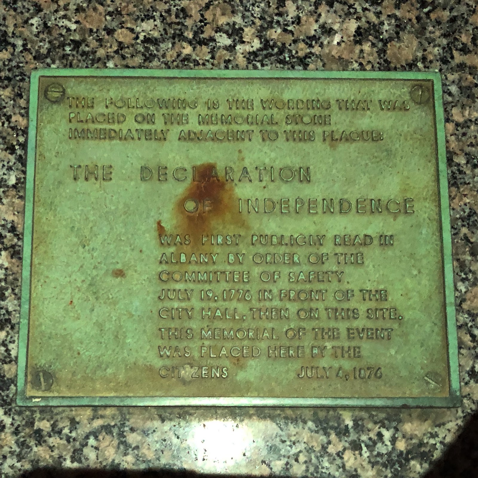
    The Mayflower is famous as the ship that brought the English Pilgrims to settle in Massachusetts Bay in 1620.  Less famous (in the northeast anyway) is the ship that brought Swedish settlers to the lower Delaware River (roughly where present-day Wilmington is) in 1638.  This began the wave of Dutch settlement in the region, largely focused from Philadelphia to Manhattan (New Amsterdam).  This morning I watched a replica of the Kalmar Nyckel motor down Buzzards Bay on her way to visit the Hudson River Maritime Museum in Kingston, New York.  That prompted me to look into the history of this ship I should have known a lot more about.  Sometimes you need the world to remind you of what you don’t know.

    The Kalmar Nyckel was built in Sweden in 1625 and named after the Swedish city Kalmar.  She had two moments in her history that should make the name more familiar than it is.  The Kalmar Nyckel’s most famous moment occurred in 1637, when Governor Peter Minuit negotiated the purchase of land from the sachems of the Delawares and Susquehannocks in the cabin of the Kalmar Nyckel on the shore of what is now Manhattan.  This transaction transferred ownership of the most expensive piece of land in North America from the Native American population to the Dutch, and lives in infamy as the most one-sided transaction ever.  The next year the Kalmar Nyckel sailed to Fort Christina (Wilmington, DE) with that first group of settlers, marking her as the first ship to bring Swedish settlers to America.

    The Kalmar Nyckel was sunk by the British Navy off the coast of Scotland in 1652, in the early stages of the First Anglo-Dutch War.  Her most famous passenger, Governor Peter Minuit, died off the coast of St. Christopher the same year that Kalmar Nickel was delivering settlers to Fort Christina in 1638, either the unlucky victim of a hurricane or a murder plot, depending on who’s account you believe.  Either way, the Kalmar Nyckel would outlive the governor by 14 years.

  • Treaty of Canandaigua

    This week, on my drive from Buffalo to Seneca Falls, I made a quick detour to visit a rock.  I live in the Granite State, so I know a thing or two about rocks, but the rock I was visiting is unique because of a tablet mounted to it commemorating the Treaty of Canandaigua on November 11, 1794.  The location of the 1902 monument, on the lawn of the Ontario County Courthouse, is roughly where the treaty was negotiated between representatives of the United States, the Iroquois Confederacy and Quaker moderators trusted by the Iroquois.

    After the Revolutionary War, American sentiment towards the Iroquois Confederacy was at a low point. The Iroquois were significantly weakened after the war, and the Americans were operating from a position of strength when they signed the Treaty of Fort Stanwix in 1784. The location is notable, as it was five miles from the site of the Orinasky ambush that wiped out many of the men from this county. Western Iroquois tribes with loyalists participated in that ambush, and seven years later a treaty was being negotiated at the fort those ambush victims were marching to relieve. The treaty ceded massive tracts of land from New York, Pennsylvania and Ohio to the Americans in an agreement known as “the Last Purchase”. The Six Nations refused to ratify the treaty but the damage was done.

    Fast forward ten years and growing tensions between the United States and Native American tribes on the western border threatened to blow up into war. Suddenly the Iroquois Confederacy seemed a significant threat should they side with western tribes and declare war on the United States. President George Washington sent Colonel Timothy Pickering, a Bunker Hill veteran from Salem, Massachusetts, to negotiate a new treaty with the Iroquois.  The location for the meeting to negotiate the treaty was chosen by another Massachusetts man, Israel Chapin.  When Chapin died a few years after the treaty was ratified, Red Jacket, once an enemy of Chapin’s during the war, gave a eulogy at his gravesite.  I wrote briefly about Red Jacket practicing his speech for Canandaigua at the spectacular She-Qua-Ga Falls previously.  There’s a deeper dive that needs to take place into the lives of these three men in particular, but also the incredible list of names on the tablet.  I can’t wait to learn more about Heap of Dogs.

    The treaty is called both the Pickering Treaty and the Treaty of Canandaigua and is still in use today.  Every year on November 11th there is a ceremony and celebration at the monument to lasting legacy of the treaty.  It undid some of the damage from the Treaty of Stanwix, and reserved land for the Iroquois that is still protected.  The land rush that took place after the Revolutionary War was like a tidal wave sweeping over New York westward.  That they were able to set aside significant tracts of land for those who called it home before Europeans settled here remains a notable achievement.

  • A Long Walk on the Erie Canal

    Leaving on a Sunday night for a business trip is never fun, but this week I tried to keep it in perspective.  Time away from home sucks, but time seeing new things usually tempers that a bit.  I got to the hotel in time to watch game 6 of the Stanley Cup finals, celebrated a Bruins win and prepped for the week ahead.  Monday would be a long day of customer-facing meetings, and by the end of the day I was ready to get outside and move.  My hotel was in Bushnell’s Basin, an especially lovely part of Perinton, New York.  A large part of the charm is the Erie Canal running through.  The tow paths have been reclaimed as walking paths, akin to a rail trail but with the benefit of a waterway on one side of you for the entire journey.

    A quick five minute walk from the hotel is Richardson’s Tavern, built in 1818 and now the oldest original canal house left on the Erie Canal.  I’ve written about it previously.  Just across the single lane Marsh Road Bridge is the Erie Canal Heritage Trail.  The bridge was built in 1912 but was just completely renovated.  It was the first time I was able to cross it to walk the trail so I made the most of it.

    The great thing about the Erie Canal is that it’s still a functioning transportation corridor.  Where once it was barges full of commerce coming from the Great Lakes to the Hudson River, today it’s largely pleasure boats making their way from point-to-point.  I thought it would have been a great place to row, with long straightaways and a convenient bike path for coaches barking instructions.  Funny how I always come back to rowing when I see the right body of water…  but today I was walking, and my goal was a quick five miles before dinner.  From the bridge I walked 2 1/2 miles towards Pittsford, turned around and walked back.

    Walking the trail, I passed walkers, joggers and bicyclers.  A highlight was watching two boats cruising the canal.  People wave to boats, and boaters wave back.  The world would be a better place if everyone else would follow their example.  This stretch of the Erie Canal is best known for a particularly challenging engineering project that had to happen to support the canal traveling through.  The Irondodequoit Creek ran perpendicularly 70 feet below the path of the proposed canal.  So James Geddes, the assistant engineer for the Erie Canal, designed the Great Embankment, a mile long, 7-story pile of rock and fill from the canal, with a 245 foot culvert to channel the creek they were building over.  This was the early 1800’s mind you, so digging and dumping required a significant labor force.  The embankment was completed in 1822.

    Back in Bushnell’s Basin after my walk, I took a right turn and headed for a new brewery that opened last year.  Named Seven Stories after the height of the Great Embankment and for the seven forms of storytelling, this brewery had great beer and better names for it.  They’re right along the canal, and I replaced my burned calories with a pint and a couple of 5 ounce tasters.  Seven Stories will be on my regular rotation on trips to the Rochester area.

    A lovely evening walking along the Erie Canal certainly beat eating at the hotel bar and watching television.  Getting out and seeing the world in earnest is my goal.  The Erie Canal Heritage Trail, paved in stone dust and lined in stretches with bollards for tying down barges once upon a time, was a lovely place to spend the final hours of Monday sunlight.

  • Talking Turkey

    This morning I went for a 3 1/2 mile walk and came across a large tom turkey standing on the side of the road. A little later in my walk I saw another turkey, this time a hen, about twenty feet up in a tree. Two turkeys in 3 1/2 miles isn’t exactly extraordinary nowadays in New England, but I was on the Cape and you don’t think of turkeys and Cape Cod. But like everywhere else in New England the turkey population has exploded.

    When I was a kid running around in the woods of various towns in Middlesex County, Massachusetts I never saw a wild turkey. The first wild turkeys I ever saw were in South Kent, Connecticut in 1993. I remember it because it was a unique experience at the time. But Litchfield County is where you might expect to see wild turkey. It’s also where I saw my first coyote in the wild. Now you can see turkey almost anywhere.

    This exponential turkey population growth took place while we (most of us anyway) weren’t paying attention. Back in maybe 2007-2008 I recall seeing a few here and there but it was still a novel experience. Today in Southern New Hampshire it’s novel if I go a day without seeing or hearing one. There are an estimated 40,000+ turkey in New Hampshire today, and an estimated 200,000+ in New England.

    It wasn’t always this way. When Europeans first settled in New England they started clearing the land for farms. This destroyed the habitat of the wild animals that lived there, and those who didn’t die out from lack of habitat were eliminated through hunting. Turkey, deer, pigeons, wolves, bear, and countless other animals suffered the same fate. By 1850 turkey were largely extinct in New England.

    Efforts to re-introduce turkeys began in the 1930’s, first with releasing domesticated turkey into the wild. When that failed wild turkey were caught in Upstate New York and released in New England states. Over time those turkey reproduced and the population growth began to accelerate. One Tom can mate with many hens, which can hatch 6-12 eggs. With few predators it’s easy to see why the population exploded. Today they’re seemingly everywhere, including a little peninsula jutting out into Buzzards Bay.

  • Crown Point

    The strategic importance of Lake Champlain during the early colonial years when the French and British and later the Americans and British were wrestling for control of this region is well documented.  Controlling the flow of supplies and men along the lake was critical, and the French chose a point of land where the lake narrowed significantly on the southern end to build Fort Saint-Frédéric in 1734.  This gave them both a foothold of consequence at a choke point on the lake and a launching place for attacks into British territory.  They held this ground until 1759, when Jeffrey Amhert’s 10,000 man army marched northward from Albany to take it.  The French destroyed Fort Saint-Frédéric as they retreated, but the strategic importance of the location wasn’t lost on the British.

    When Amherst’s army reached the destroyed French fort, they immediately set to building a much larger fort next to the location of the original.  In fact, if you look at satellite  image of the location you can see the faint outline of the French fort right next to the larger British fort that replaced it.

    Walking around on this site you feel just how exposed you are to the elements.  For the soldiers stationed here, it must have been brutally cold in the winter.  The large fireplaces for the upper and lower floors in the officer’s quarters must have been heavily utilized during those winter months.  Officer’s quarters were much nicer and the fireplaces much bigger than those of the enlisted men.


    Ultimately Crown Point fell into disrepair as the threat from the French disappeared and threats from the Native American population moved further and further west.  The strategic importance of Crown Point was also diminished by the decision to strengthen Fort Ticonderoga closer to where Lake Champlain and Lake George overlap.  The other concern about Crown Point was that it was set on a peninsula, and thus soldiers manning the fort would become trapped there should the land it connected to be controlled by the British and their Native American allies.  That proved a salient point as the Continental Army was barely controlling the lake at this time let alone the western lands adjacent to Crown Point.

    Walking along the top of the earthworks the British built, it’s easy to see just how clear the sight lines were for the cannon overlooking the lake.  Ironically the fort was never directly assaulted and never fired a shot at a passing ship as far as I can tell.  The Green Mountain Boys overwhelmed a skeleton crew manning the fort in 1775, shipped many of the cannon to Boston (along with many from Ticonderoga), and then the Continental Army opted to abandon Crown Point in favor of what they believed to be stronger ground at Ticonderoga and Fort Independence in 1777.  The British took back control of Crown Point and held it until the end of the Revolutionary War in 1783.  This was the last hurrah for Crown Point, and it fell further into disrepair until it was declared a National Historic Site.

    I’ve walked the grounds of Crown Point once in the spring, and hope to get back there sometime when they’re open for tours.  Perhaps I can combine a visit with one I’m planning later this year for Fort Ticonderoga and Fort Independence.  I’d also like to hike up Mount Defiance to round out my knowledge of the campaign and to complete my tour of this region.


  • The Corner of Broadway and Hudson

    One of the more significant street corners in American History is the intersection in Albany where Broadway meets Hudson Avenue.  This is the site of the old Stadt Huys where in 1754 representatives from several colonies met to discuss the Albany Plan of Union.  This group, known as the Albany Congress, consisted of a few famous men from the time, but the most famous of all was Benjamin Franklin.

    Coincidently this site, 23 years later, was also the location where the Declaration of Independence was first read in public.  Albany was a critical hub during both events.  In 1754 Albany was the edge of the wilderness.  In 1776 Albany was the center of the Northern Army’s efforts to repel the British Army, which was attempting to cut New England off from the rest of the colonies by seizing control of the Hudson River.

    Reading the Declaration of Independence in Albany had a galvanizing effect on the people who heard it.  Remember, Albany was under siege from all sides in the summer of 1776.  The British had swept over Long Island and Manhattan, and occupied New Jersey downstream.  They had just taken control of Lake Champlain to the north – a critical highway for troop movement from Canada.  And the Iroquois were allied with the British just to the west.  Albany was in a precarious position on July 19th when the Declaration was read.

    In 1876, according to The Friends of Albany History, a ceremony commemorating the centennial of the reading happened in this spot:
     “Before a gathering of “two or three thousand” Albany residents, the tablet, which was covered by an American flag, was unveiled by Visscher Ten Eyck (Matthew Visscher’s grandson.) The tablet’s reveal was greeted by hearty cheers from the crowd, patriotic songs, chimes from the steeples of nearby churches, and a 100-gun salute.”
     
    Tonight, almost 141 years since that ceremony, 241 years since the Declaration was read in this spot, and 263 years since Ben Franklin led the Albany Congress to draft the Plan of Union, I had a couple of pints across the street from the commemorative plaque and stone that marks the site.  There are many people in history whom I’d like to have met, but Ben Franklin is high on that list.  Since I can’t have a drink with him having two pints with a nod to history will have to be close enough.
  • Lick Brook Falls

    This morning I woke up and thought I’d tackle one more waterfall before I shut down this grand tour of Ithaca area waterfalls.  I drove 7 minutes up the road to Lick Brook Falls at Buttermilk Falls State Park.  This is a lovely and quiet spot, especially on a Sunday morning with icy, muddy trails to contend with.  So on went the micro spikes over the boots.  I’ve worn that combo a lot this weekend and never was it more needed than on this hike.  Steep downhill stretches were a sheet of ice, all the more treacherous because if you slipped you’d likely end up in the fast moving stream.

    So I cautiously made my way down the icy trail.  I’m not timid, but I do have a fondness for living.  And not getting hurt again.  After all I was flat on my back cracking a rib just two weeks ago.  I’m getting older but I still remember THAT.  I also did the mental math – I was one of two cars parked the trail head, and what were the odds of me being discovered should I slip?  Not good.

    No sooner had I said that than a trail runner came dashing down the hill behind me.  It was his fourth loop of the trail I was hiking down.  And yes, he was wearing micro spikes, but he was also hustling down the steep icy path I’d just descended.  And he was wearing shorts.

    I told him that he was a better man than me, got a quick download on the trail ahead and wished him God speed.  He reminded me of the thru hikers we saw hiking through Mahoosuc Notch.  I’d be moving at what I thought was a decent speed only to have those thru hikers blow right by me.  All you can do is salute them and move along at the speed that makes sense for you.  And that’s exactly what I did with that trail runner.

    Lick Brook Falls is really three falls.  The from the bottom to the top, Lower Lick Brook Fall drops 25 feet, moving up the trail, Middle Lick Brook Falls drops 47 feet and then Upper Lick Brook Falls drops 93 feet.  This third drop ranks Lick Brook Falls as the fifth highest waterfall in the Ithaca area.  It’s similar to Lucifer Falls for its relative isolation compared to the other falls on the top five, but unique for its three drops.  This one reminded me a lot of hiking along a mountain stream in the White Mountains.  The hemlock, oaks and maple trees certainly helped with that impression.

    Ultimately I did three more waterfalls today, but I’ll save those for another post or two.  If I’d just done this one today I’d have called today a victory.  There are some incredible stories that came out of the others, and they’re worth a post of their own.  Hiking the “blue” Lick Brook Trail in February paid off with plenty of water, ice sculptures and isolation.  It occurred to me more than once on the trail that there was nowhere else I’d rather have been at that moment.

    According to the Sweedler adn Thayer Preserves website, this area was protected from development when “Moss Sweedler purchased the “Lost Gorge” in the 1970s, and understanding its uniqueness, decided to leave it to the Finger Lakes Land Trust in his will.  But in 1989, the Land Trust let the Sweedlers know that Lick Brook was a top priority for protection, recognizing the development pressure in the area and the site’s exceptional beauty, and in 1993 the Land Trust purchased 128 acres from Moss and Kristin Sweedler at a bargain price, creating the Sweedler Preserve at Lick Brook.  Since then the preserve has provided public access to one of the most remarkable waterfalls and gorges in the area.”

  • Four Waterfalls in One Afternoon

    I found myself with an afternoon to myself today while in Ithaca, New York.  Ithaca is a great college town with plenty of restaurants to choose from and enough shopping to occupy those who are inclined to spend their lives in retail environments.  I’m not one of those people.

    I decided to make the waterfall circuit.  Now, Ithaca has a lot of waterfalls and I only had half a day of daylight to work with, so I tried to choose wisely.  You can’t go to Ithaca and not view Ithaca Falls, so that was on the list.  But so was Buttermilk Falls, Taughanock Falls and Lucifer Falls.

    I started with Taughanock Falls.  This was the furthest away but one I really wanted to hike to.  I drove out to Ulysses and changed into my winter boots for the hike.  I’d contemplated this hike before I drove out here so I also put on micro spikes, as I expected the conditions to be icy.  My expectations were met.  The path to the falls was about a mile long with a mix of ice, snow and mud.  I passed 50 or 60 people on this walk and I was the only one wearing micro spikes.  A few people pointed to them and said they wished they’d thought to bring them too.  Taughanock Falls on a mild February day were spectacular.

    Next on the list was Buttermilk Falls.  This one was right down the street from my hotel and easy to get to.  No hiking boots required, just park and walk over to take a picture.  Buttermilk Falls are beautiful, but there’s no real effort required to see them.  I like to earn my scenic vistas.

    Third waterfall was Ithaca Falls.  This is another easy one right off the road.  In fact, you can technically see the falls from the road, which is how we first discovered them.  But I put on my boots again and walked out to the falls for another picture.  Quick walk but well worth the effort to get closer.

    Finally, I drove out to the Robert H. Treman State Park to see Lucifer Falls.  Waze sent me past the state park parking lot to the service road on the other side of the Enfield Creek.  This ended up working out really well as there was a nice path down to the creek on that side.  This was another hike where micro spikes were invaluable.  I’m not sure I would have chanced the hike without them.  This hike reminded me of New Hampshire.  There were hemlock trees shading the path, and with the icy conditions I was one of the only people out on the trail. 

    There’s a bumper sticker available in many of the stores in Ithaca that says “Ithaca is Gorges”.  It’s a nice play on words of course, but right on point; Ithaca’s Gorges are indeed gorgeous.  When you get off the city streets Ithaca offers plenty of views that are well worth the effort to find.  I’m glad to have had the opportunity to see these four waterfalls today.  I’ll definitely go back to each one again, and especially Lucifer Falls.

  • New Hampshire Grant

    New Hampshire Grant

    The land that is today Vermont was once claimed by Massachusetts, New York and New Hampshire.  The Massachusetts claim originated from a fort established in the Connecticut River Valley in present-day Brattleboro.  New York based their claim on original Dutch territorial claims that all the lands west of the Connecticut River to Delaware River were theirs.  When the Dutch were ousted from North America New York followed the same general borders, which were validated by King George II.

    New Hampshire Governor Benning Wentworth chose to follow his own guidelines, choosing the western border of Massachusetts and going north to Canada and east to the Connecticut River as land he had jurisdiction over, which he then granted to middle class farmers who settled the land.  New York was granting the very same land to wealthy landowners and wasn’t particularly pleased by Wentworth’s interpretation of the borders.  These wealthy landowners then tried to tax the middle class farmers on “their” land, which led to even more tensions.

    The most famous of these middle class farmers was Ethan Allen, who was a natural self-promoter.  Allen and other farmers formed the Green Mountain Boys, who organized armed resistance to New York.  The escalating confrontations between the New Hampshire Grantees and the New York grantees continued until the beginning of the Revolutionary War forced all parties to focus on a larger problem.  Eventually New York gave up and Vermont would become a state.  There’s still an independent streak in Vermont and New Hampshire to this day.  Perhaps there’s still some lingering annoyance on the part of some wealthy New York family who’s ancestors gave up the fight for lands they were granted.

  • Pabos: A Long Way From Home

    On the edge of a lawn on County Road 42 in Fishers, New York is a seven foot pyramid built in 1959 to honor a man named Pabos.  Pabos was a Basque explorer who traveled deep into the wilderness of North America only to die here 400 years ago on June 10, 1618, a little more than two years before the Pilgrims settled in Plymouth.  His grave is one of the oldest known European graves in North America.  That his final resting place was here in this Rochester suburb is fascinating.  That he is remembered at all is an accident of history.

    The Basques are people from the region in Spain that borders France.  They were focused on commerce, not settlement, and were very active fishing, whaling and trading in the Gulf of St Lawrence in the 15th and 16th centuries.  They would sail over from Spain and establish semi-permanent fishing and hunting camps in that great estuary, fishing for cod and hunting whales for a century before Jacques Cartier explored the St Lawrence River and claimed the northern lands for France.  The Basque traded with local tribes and learned to speak their languages.  Over the decades they moved further and further inland up the St Lawrence River, eventually reaching Lake Ontario and beyond.  Like his fellow Basque explorers, Pabos was likely looking for new fishing grounds, tribes to trade with and for the elusive Northwest Passage to Asia.  He likely followed the shoreline of Lake Ontario to Irondequoit Bay and then up Irondequoit Creek to see where it would take him.  Pabos may have been the first white man to walk through the old-growth forests that covered Western New York in 1618.  How he died is lost to history, but disease, illness, accident and violence claimed many explorers and the native tribes they encountered along the way.  Smallpox and other diseases brought by early visitors decimated local tribes well before the first permanent European settlers arrived.

    Almost two centuries before Victor, New York was incorporated as a town in 1812 and laborers started digging the Erie Canal something took the life of Pabos in this remote corner of Upstate New York.  What we know is he wasn’t alone.  Someone in his party buried him 300 feet from this monument and marked his grave with a limestone gravestone engraved with his name and the date of his death.  And it was there that Pabos rested in peace, lost to history until his grave was discovered in 1907 by Fred Locke, inventor of the porcelain insulator.  Locke was digging for clay when he unearthed the limestone marker of Pabos’ grave.  Had Pabos been laid to rest a few hundred feet away, his grave may never have been unearthed.  Lost forever to the accumulation of sediment, or covered over by the construction of Wangum Road or the Auburn and Rochester Railroad.

    The larger pyramid monument that sits alongside Wangum Road was built and dedicated in 1959 after a decade of extensive research on Pabos by George Sheldon.  That dedication was noted in the Rochester Democrat and Chronicle on June 10, 1959.  Sheldon and the local Boy Scouts built this pyramid and placed the plaque to honor Pados.  The actual gravesite sits 300 feet away from the pyramid on private property.  Portions of the trail he walked his final steps on still exist to this day.

    Pabos thus lives on because someone in his group carved his name and date of death on a piece of limestone, and someone stumbled upon that limestone 289 years later, and someone a generation after that dedicated ten years of his life researching the Pabos and how he came to be in this place, and with the support of the community dedicated the pyramid monument that marks this path through history.  Ironically, the person who survived and paid tribute to him with the carved gravestone is lost to history.  Yet they set in motion the series of events that bring us to this moment, 400 years later, acknowledging a Basque explorer who died alongside a creek deep in the wilderness far from home.