Category: History

  • Sassafras

    Serendipity placed me in front of sassafras twice in almost exactly 24 hours. Yesterday I was with a friend and expert forager who saw it on the edge of the woods. He pointed out each of the three unique leaves of the sassafras tree and pulled out a small root for me to smell.

    Today I visited the Aptucxet Trading Post Museum in Bourne, Massachusetts and what do I see but a sassafras tree! The museum guide pointed out the leaves, scratched the root to have me smell and it was déjà vu all over again.

    The original tea that settlers in North America drank and exported was made from the root of the sassafras tree. Sassafras was used for other things ranging from shipbuilding to toothbrushes, but when you smell it you probably think of root beer. And of course you’d be right; the oil from sassafras root gives flavor and the name to root beer. That was my favorite soft drink growing up. I don’t drink it sugary drinks anymore, but at the moment I’m craving some root beer. Instead, I purchased some sassafras tea from the gift store at the Aptucxet Trading Post Museum and will make a sugar-free sassafras drink. And toast the tree it came from.

  • The Yin and Yang of New Hampshire and Vermont

    “She’s one of the two best states in the Union.
    Vermont’s the other. And the two have been
    Yokefellows in the sap yoke from of old
    In many Marches. And they lie like wedges,
    Thick end to thin end and thin end to thick end,
    And are a figure of the way the strong
    Of mind and strong of arm should fit together,
    One thick where one is thin and vice versa.”

    – Robert Frost, New Hampshire

    New Hampshire and Vermont are Yin and Yang.  Almost flipped mirror images of one another, as Frost describes.  The people are similar in so many ways, and different in so many other ways.  Generally, Vermont is a “blue state” while New Hampshire is a “red state”, traditionally voting Republican (much to the chagrin of Vermont and Massachusetts).  New Hampshire has a certain active principle, Live Free or Die vibe going, while Vermont embraces a more receptive, Freedom and Unity vibe.

    The Connecticut River defines the border between the two, as determined by King George III in 1763. Vermont didn’t exist back then, the land was deemed New York’s. But that didn’t last very long; about the time it took for New York to try to collect taxes from the people there. Ethan Allen and the Green Mountain Boys chased the tax collectors right out and Vermont seceded as the American Revolution was ramping up. That’s a very New Hampshire thing to do! And ever since, these two states have been locked in an eternal embrace; interconnected yet independent. White Mountains and Green Mountains, conservative and liberal, two of the smallest states in size and population; wonder twins holding up the northern border and hugging each other for eternity.

  • From Falkirk To Portsmouth

    206 years ago next week, on September 10, 1813, the British brig General Hunter was captured after the Battle of Lake Erie. That battle deserves more attention, which I’ll try to offer on another day. This story is about the journey a pair of cannon took from the banks of the River Carron in Falkirk, Scotland to their current home near the banks of the Piscataqua River in Portsmouth, New Hampshire. The guns are of course inanimate objects, but darn it they’re surely survivors.

    Once a part of the arsenal on the brig Hunter for the British, captured and turned to service for the Americans on the brig USS Firefly, the cannon saw service in the War of 1812, the Second Barbary War of 1815 before being retired from active duty and sold with the Firefly to a wealthy merchant from Portsmouth named John Peirce. The guns were on two of the Peirce merchant ships before finally becoming a family heirloom, donated and placed in their current location more than a century ago. As Portsmouth changed they were moved closer to the building to where they are now.

    I’ve come across the guns a couple of times while walking through Portsmouth. And I’ve done a double-take each time. The ships they were in are long gone, and so are a succession of crew and wealthy owners who once valued the utilitarian efficiency of these weapons. Today they’re no longer lethal, instead standing permanently at attention, muzzles buried in the earth, as tourists, drunkards and businesspeople alike drift past, oblivious to their violent history.

    They flank the entrance to the Portsmouth Athenaeum, itself a curiosity in this modern world. The building is almost as old as the guns, and they guard it like older twin brothers might protect a younger sister. Saved from anonymity by the plaques proclaiming their role in the Battle of Lake Erie. But they’d only part of their story. Imagine all these cannon have witnessed, and the stories they could tell.

  • His Majesty’s Pleasure: The Expulsion of the Acadians

    During the French and Indian War the British looked at Nova Scotia, New Brunswick and Prince Edward Island and saw a threat.  The Acadians, original settlers to this area from France, had been allowed to remain for 40 years after France had conceded this territory after the capture of Port Royal in 1713.  But the Acadians had never pledged an oath to Britain, and the resumption of hostilities in the French and Indian War became the tipping point.  How many in North America suffered because the French and English couldn’t get along?  Too many.

    Beginning on August 10, 1755 the British began rounding up Acadians and expelling them.  Often families were separated, with husbands and wives, mothers and children being sent to different places.  It reminds me of what happened to Japanese Americans in World War II, and what’s happening now on the Mexican border.  The weakness of moral character in people in power causing immense suffering for those who are powerless.  You can have homeland security without being an asshole.

    Henry Wadsworth Longfellow heard about the expulsion of the Acadians from Nathaniel Hawthorne.  There’s a moment when I’d have loved to be a fly on the wall listening in.  Longfellow then wrote a poem called Evangeline that told the plight of a fictional character of the same name trying to reunite with her husband.  The poem brought attention to the expulsion then, and still offers insight into their suffering now.  The Acadians were lured into church to hear at announcement, only to find out that they were prisoners, and their world was being turned upside down.

    “Then came the guard from the ships, and marching proudly among them
    Entered the sacred portal. With load and dissonant clangor
    Echoed the sound of their brazen drums from ceiling and casement, –
    Echoed a moment only, and slowly the ponderous portal
    Closed, and in silence the crowd awaited the will of the soldiers.
    Then uprose their commander, and spake from the steps of the altar,
    Holding aloft in his hands, with its seals, the royal commission.
    “You are convened this day,” he said, “by his majesty’s orders.
    Clement and kind he has been; but how you have answered his kindness,
    Let your own hearts reply! To my natural make and my temper
    Painful the task is I do, which to you I know must be grievous.
    Yet must I bow and obey, and deliver the will of our monarch:
    Namely that all your lands, and dwellings, and cattle of all kinds
    Forfeited be to the crown; and that you yourselves from this province
    Be transported to other lands. God grant you may dwell there
    Ever as faithful subjects, a happy and peaceable people!
    Prisoners now I declare you, for such is his majesty’s pleasure!”
    – Henry Wadsworth Longfellow, Evangeline

    Many of the Acadians would end up in Louisiana, and their descendants are Cajuns.  Others would go to the thirteen colonies.  Some would eventually go back to Nova Scotia, New Brunswick and Prince Edward Island.  Many others died before they reached a destination.  It a dark stain in the history of a beautiful place.  And it offers a lesson we often forget.  The decisions of a few can disrupt the lives of many.


  • I’ll Take Crickets

    PT Barnum was born in Bethel, Connecticut on July 5, 1810. He is buried in Bridgeport, Connecticut, where he once served as Mayor. So he’s as much a son of Connecticut as anyone, but is mostly known for being that circus thing. He demanded attention, and is known still as the greatest showman. I have very little interest in the man… but my grandfather was fascinated with the circus, and so PT Barnum is a curiosity.

    “Audentis Fortuna iuvat” (Fortune favors the bold) – Virgil

    This morning I was sitting in a completely unremarkable diner in Connecticut. Bland food, horrible coffee, no soul. The kind of place Hollywood would use to show the bland existence of some poor character before they woke up and sought more in their life. When they asked me whether I wanted white or wheat toast I knew I had to get out as soon as possible.

    There are parts of Connecticut that are lovely. I forever think of Kent fondly, not because of the private school, trendy stores, or a past relationship (gone horribly bad), but because of the stillness away from Route 7. There’s magic in those hills, and in the light buzz of crickets in the fields, and in the white water of the Housatonic River at Bulls Bridge. I made my way up there on my drive to Dover Plains. Some detours are more essential than others. The hills and crickets offer the same song, and there’s more Manhattan money than ever in this tiny town. We all seek solitude, some pay a premium for it. But the bridge looks about the same, and I drove through a 26 year time warp crossing it. On the other side of that time warp I appreciate where I am now.

    The residents of Bethel put up a statue of old PT Barnum showing him in his most dynamic days. I drove by early this morning because I don’t like sitting in hotel rooms longer than I need to, or soul-suckingly bland diners. The statue was erected in 2010, not all that long ago, and its clear Bethel wants to celebrate their connection to Barnum. I stopped by, took a picture and got on with my day. A nod to my grandfather. He loved the vibrancy of the circus, and old PT offered an association with that vibrancy. Perhaps he was as grandiose as history suggests. But I’ll take crickets, thank you.

  • Stone Eggs and Red Dye

    The weekend was frustratingly productive in a Monday morning regret sort of way. Saturday was full of chores – cleaning, pruning, weeding and such. Sunday began the same way, but I felt the stir of restlessness mid-morning and started plotting concentric circles outward for places we’d never been before. When you’ve lived in a place for most of your life that’s challenging, but also surprisingly fruitful. Interesting walk with water views within an hour of home? Not hard when you live near the sea. Place you’ve never been to within that circle? Bit more challenging, but it turns out, not impossible.

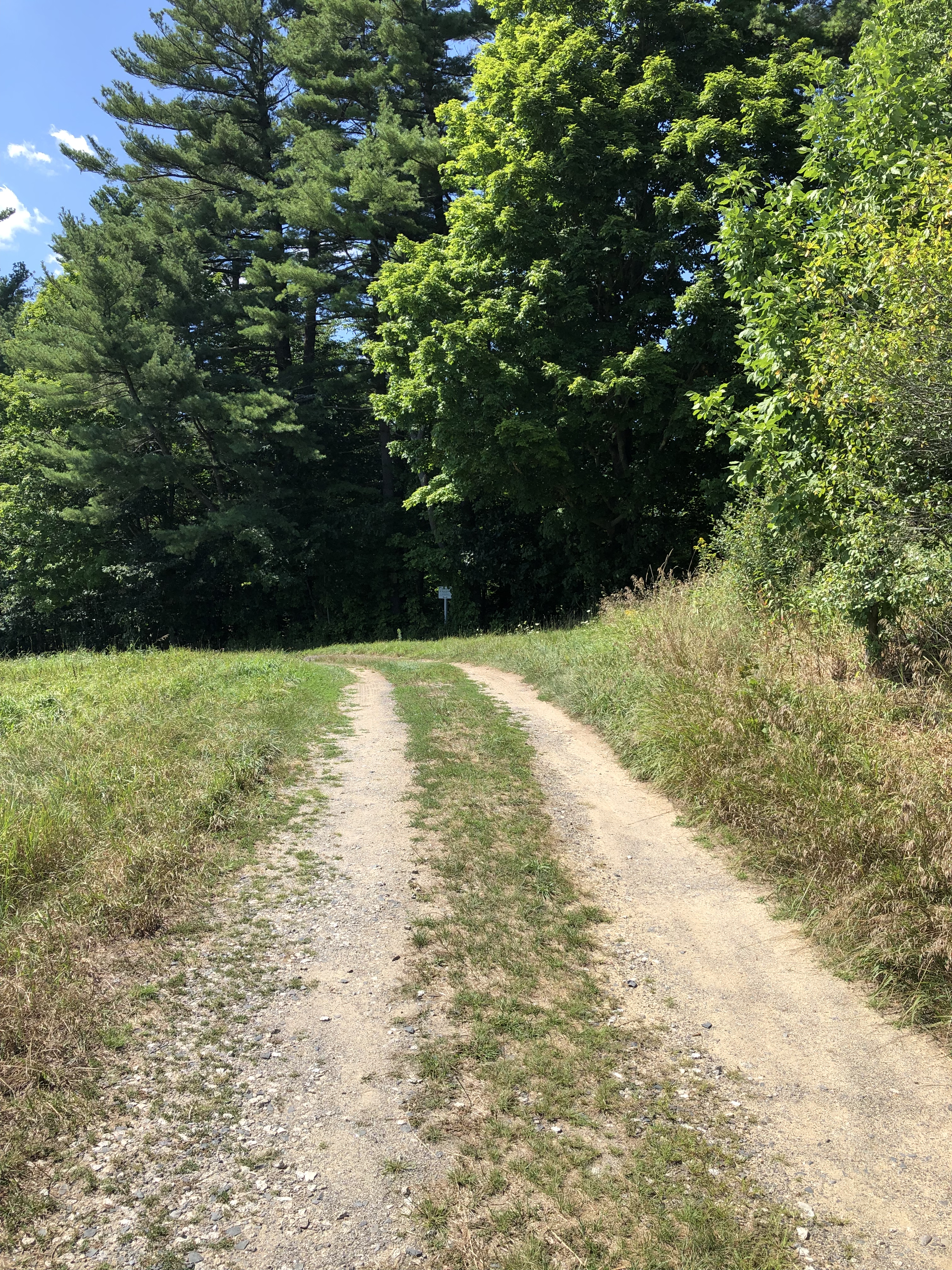
    Kittery, Maine is one of those places I drive through on my way to someplace else. Sure, they have all those outlet stores, but shopping makes my brain ache. So does the Sunday traffic trying to bridge the Piscataqua River. Bridges are chokepoints, and being on the wrong side of one on the last weekend before all those kids go back to school is a recipe for gridlock. But the call of new trumped logic and we made our way to Fort Foster for a Sunday afternoon walk.

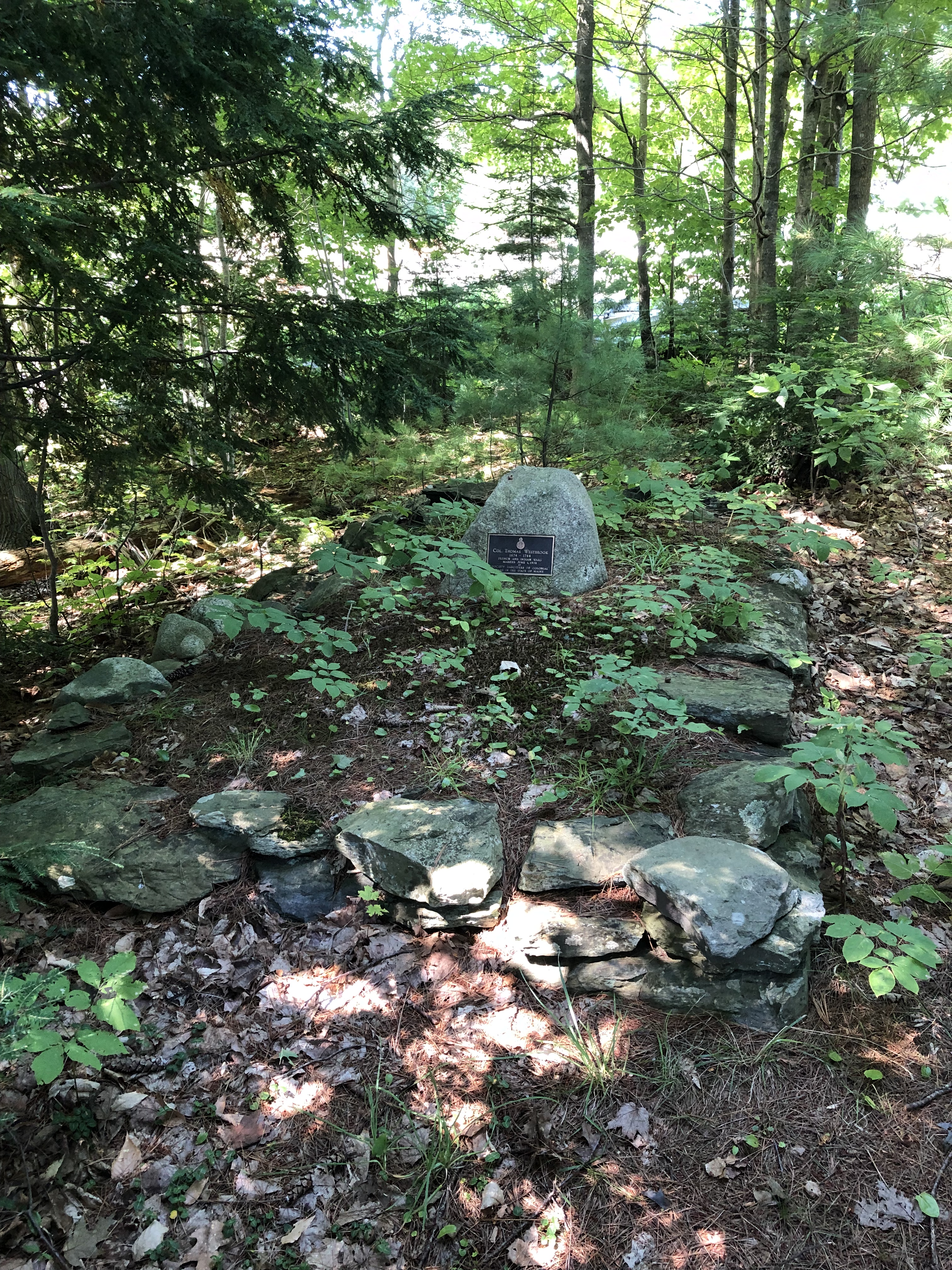
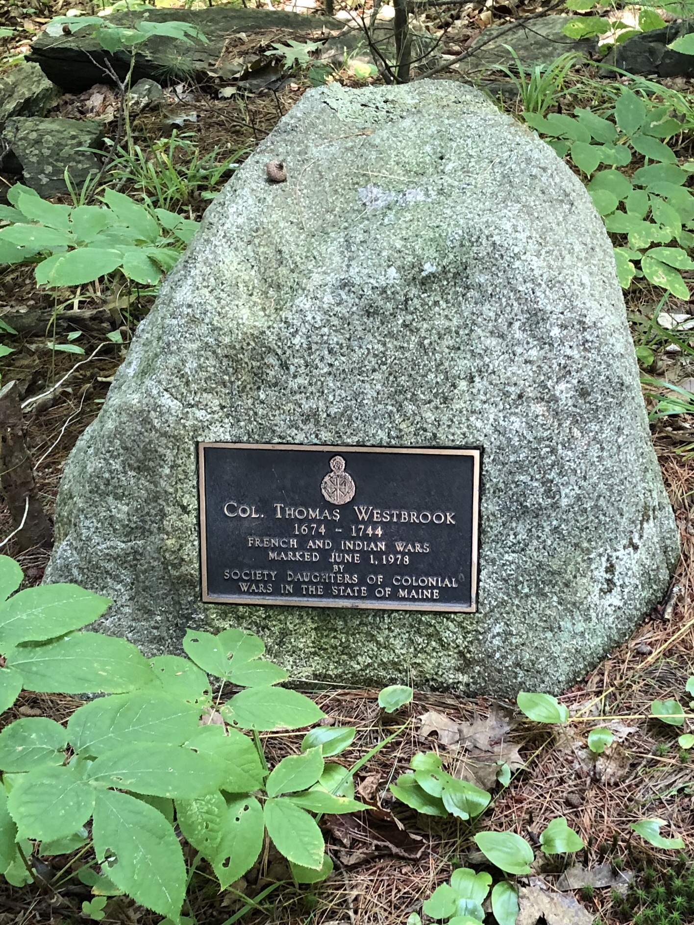
    Fort Foster sits on the northern point of the Mouth of the Piscataqua River. Historically this river has always marked the boundary between New Hampshire and what was first the Commonwealth of Massachusetts and eventually Maine. The strategic merits of the river and the natural reluctance of the Native American population and the territorial turf war with the French created the need for forts.  That need was served by Fort McClary, just a few miles inland and visible from Fort Foster.  So why another fort?

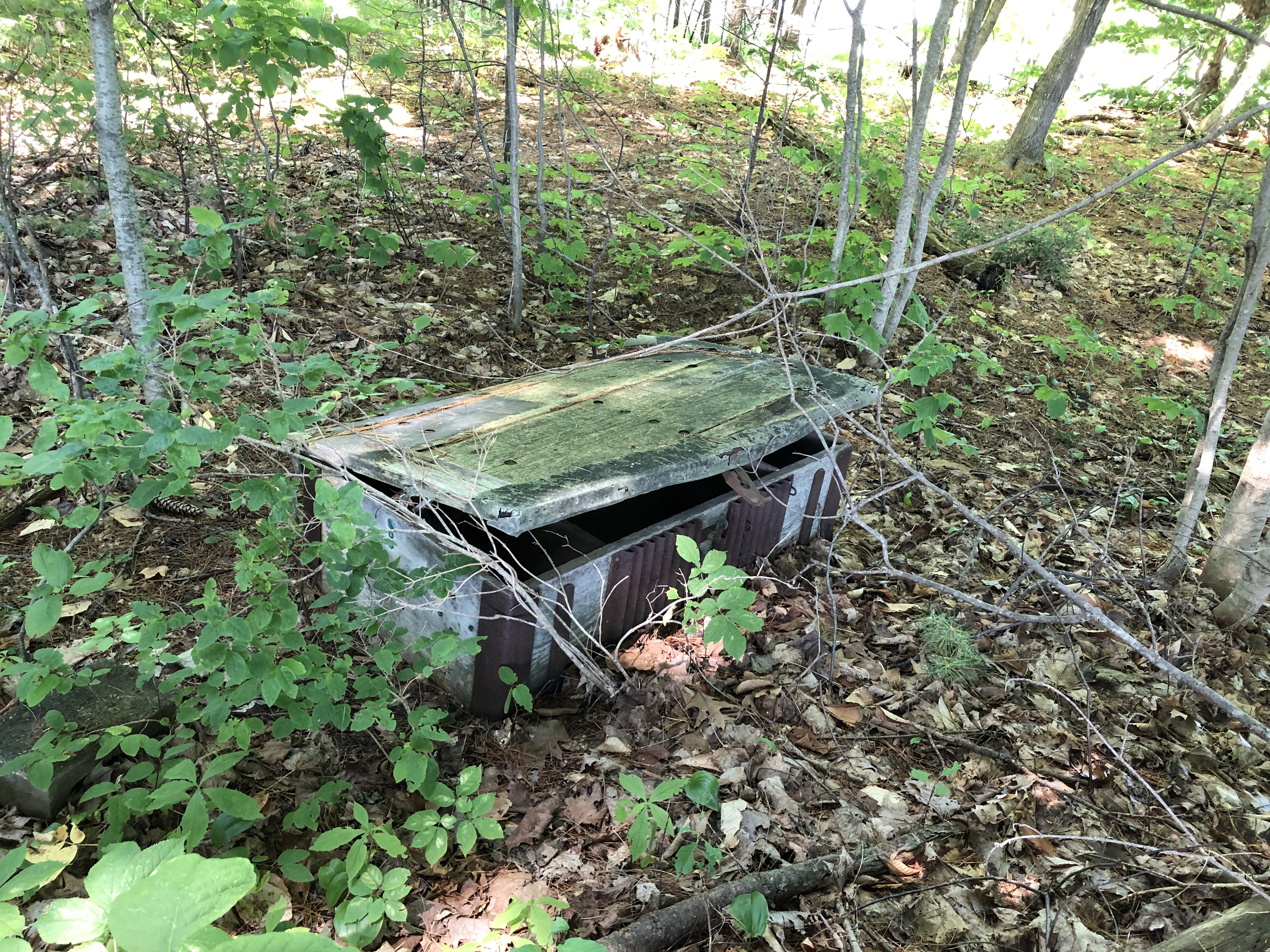
    In 1885 the United States determined a need to bolster coastal fortifications for modern warfare.  At the time, this included concrete bunkers, disappearing gun artillery designed to combat the new steel-plated modern ships, and most interestingly, anti-submarine measures like mining and guns designed to fire on submarines.  These forts dotted the east and west coasts of the United States.  Fort Foster was completed in 1901, and was active until just after World War II, when the realities of modern warfare had made coastal forts obsolete.

    Fort Foster today offers glimpses of that past.  You can still climb up into the concrete bunker and see the bolts that once secured the disappearing artillery.  But the real reason to visit Fort Foster is to walk on the unique beaches at the Mouth of the Piscataqua River, walk out on the pier to get a closer look at Wood Island with it’s lifesaving station, and Whaleback Light.  There’s been a lighthouse on this spot since 1820, and the one you see now was built in 1872.  The lighthouse keepers surely had a lonely job on that pile of rocks.

    The beach along the river is hard-pack sand cemented with silt, with granite cropping out wherever it may.  We visited at low tide and the beach extended out 50 to 100 yards in spots.  But there was a funk in the air that betrayed bacteria, and we moved on from the river beaches to those facing the ocean.  The City of Portsmouth, New Hampshire, just on the other side of the Mouth, poured a red dye into the river last month to analyze sewage flow.  There’s a red tint on the seaweed and beaches at low tide, and I wasn’t sure whether it was the red dye or the pervasive Red Tide that has closed shellfish sites in Maine for most of the summer.  Either way, it’s not a beach I would sunbath on, let alone swim in.  Damned shame, because it is a beautiful spot.

    Rounding the corner the funk disappears as the ocean breezes refresh the air.  We walked along the beach at Sewards Cove.  The beach is a fascinating jumble of worn stones, granite outcroppings and stone dust.  Picking up the stone dust, it radiated heat that lingered longer than typical beach sand might.  The beach was dominated by the rounded stones, like river rock you might put in a potted plant, of varying sizes.  One imagines the surf churning these rocks together, round and round, wearing the sharp edges down to smoothness.  The result is lovely, with all manner of shapes and sizes, all eventually becoming that stone dust that makes up the rest of the beach.  I rescued a half dozen egg shaped stones from that fate, instead subjecting them to the fate of eye candy in a beer glass on a shelf at home.  If stones had feelings they might rejoice or resent this fate, but they’ll never tell me.

    We walked as far as we could before we reached a sign that said private property, and turned back towards the river.  We opted for the path instead of the beach on the walk back, and passed groups of families and friends picnicking in nooks and crannies of the park all the way back.  It’s a million dollar view out to the Isle of Shoals and beyond to the east, and over to Portsmouth an Odiorne Point on the opposite shore of the Mouth looking south.  The park charges $20 per car, or $5 per person.  Many people simply park outside the gate and walk in, but anything more than three people and the math stops working for you.  We gave the $20 bucks and called it a donation.  Public space on the ocean is a blessing, and that private property sign reminded me that not every shore is accessible.  Andrew Jackson for a Sunday afternoon walk somewhere new?  A good trade in my opinion.

  • Bunker Hill

    The walk up Pleasant Street gives you a sense of what the British were up against, and why the American militia chose this spot. Beginning at The Warren Tavern, the climb is gradual at first, but very steep as you approach the crest. Waking up to a locked and loaded enemy staring down that hill would have been unacceptable, and action would be required. Just the sight of the British regulars lined up and marching towards you must have been terrifying, and the British knew that and counted on the effect it would have. But on this day terror wouldn’t budge the bold easily.

    Events of that day are well-documented. Heroic figures rose up, died or survived to fight another day. William Prescott commanded the Americans, uttering some of the most famous words of the war (in a war full of famous words) when he shouted to his nervous militia “Do not fire until you see the whites of their eyes!” to conserve ammunition. Israel Putnam and John Stark were heroes that day as well, using their experience in the French and Indian War to offer critical tactical insight. The British side features famous names as well; Thomas Gage, William Howe, Henry Clinton, James Abercrombie and John Pitcairne. For the latter two Bunker Hill would be their last battle.

    The Bunker Hill Monument stands on Breed’s Hill, which is where the bulk of the fighting took place on June 17, 1775. I’ve driven by the monument thousands of times, but only remember climbing up the stairs inside once. Not in the cards on the day I visited either, as my walk up from the tavern around the perimeter and a bit of time to re-marinate myself in my local history chewed up all of the allocated time. But I was pleased with the site, which offers appropriate reflection.

    I’d started by walk up the hill at The Warren Tavern, founded five years after the battle and named for Joseph Warren, the 2nd President of the Massachusetts Provincial Congress, who would become a martyr that day. Warren refused the safety his position offered him and choosing instead to be where the fighting would be worst. He died from a musket ball to the head, and then had his body brutalized by the British, whose heavy losses taking the hill likely inspired vengeance. Warren’s close friend Paul Revere helped exhume his body for burial elsewhere, a sign of the great respect Warren had earned in his life.

    That the bulk of the battle happened on Breed’s Hill is mostly known, but people still think the monument is on Bunker Hill. Sometimes the details get mixed up in the story telling. I love a good story and there were many on that hill on June 15, 1775. I’d say I’m better than many in knowing those who came before, but as with everything you learn as much about what you don’t know, and I appreciate a good refresher course. I’ll dance with the ghosts longer next time. There’s so much more to learn from them.

  • The Secret Burial of Colonel Westbrook

    In the middle of the night 275 years ago a group of family and friends buried the old Colonel in an undisclosed location to keep his body from being dug up and used as a bargaining chip by creditors.  That this war hero was in this position was regrettable, but 1744 Maine was a hardened world not prone to sentiment.  The final years for Colonel Thomas Westbrook were spent in a battle with his old business partner and fellow soldier.  And it was that battle that brought his family and friends out in the middle of the night to bury him, keeping the location of his grave a closely held family secret until the Bicentennial in 1976, an anniversary that settlers in 1744 couldn’t even conceive of.  They were far more concerned with the very real threat of the French and Abenaki than they were about breaking from Great Britain.

    It’s understandable if you have no idea who Colonel Thomas Westbrook is. Frankly I didn’t know who he was until 10:15 this morning, when I passed a sign for the Colonel Westbrook Executive Park on Thomas Drive (well played).  Being in Westbrook, Maine I was curious about a man who accomplished enough in his time to warrant a town being named after him. Which brought me to discover blueberry cheesecake ice cream. But perhaps I’m getting ahead of myself.

    Colonel Thomas Westbrook famously raided the Abenaki village at Norridgewock in search of Father Sebastien Rales (or Rasles, depending on whether you read the English or French description of the man).  Rales led Indian raids on English settlements in Maine (then part of Massachusetts), and by 1722 the English had had enough of it.  Enter Colonel Westbrook who raided Norridgewock but failed to capture Rales.  He did manage to confiscate Rale’s strong box, which had incriminating evidence of coordinating with the Abenaki to raid the English settlements.  This evidence became gas on the fire, igniting more hostilities between the French, English and Abenaki.  In 1724 another raid on Norridgewock resulted in the massacre of 100 Abenaki and Father Rales.  Westbrook wasn’t involved in that event, though his confiscation of the strong box provided plenty of motivation for those who did.  This was indeed a violent time in Maine, with atrocities committed on both sides.  Norridgewock was yet another example.

    Searching for information on Westbrook while I waited for my lunch appointment led me to an article about the discovery of his gravesite, which led me to Smiling Hill Farm, where I asked for directions to the grave site at the ice cream stand along with what their favorite ice cream was, which led me to that blissful blueberry cheesecake ice cream, which – finally – led me to a brief visit with the Colonel. Once again I found myself off-roading in dress shoes. I should really keep some old running shoes in the car for these unplanned detours… but I digress.

    The gravesite sits between a large grass field and a paved lumberyard. Colonel Westbrook was once the Royal Mast Agent supervising the harvest of white pines for the Royal Navy, so I think he’d get a kick out of the ongoing lumbering activity feet from his final resting place. He may be staring up at the planes taking off from the Portland Jetport wondering what the heck is going on in the world though.  Jet engines roar over the white pines that were once the critical material for the cutting edge transportation technology of the 1700’s.  Times have changed, but on the whole the place he’s buried would be familiar for him.  Smiling Hill Farm remains largely as its been for generations, operated by the Knight family since 1720.  They surely know a thing or two about Colonel Westbrook.

    I walked the dirt and gravel road (mostly a pair of tire tracks) around the front of the lumber yard and there it was, a small white sign in front of a patch of woods marking a quiet, overgrown grave.  This was the site that was revealed to the public in 1976 during the Bicentennial, making Colonel Westbrook famous throughout the area.  There’s a good article that helped me greatly commemorating the 40th anniversary of that Bicentennial celebration posted in the Portland Press-Herald on August 4, 2016.  Two years later it seems the Colonel has been largely forgotten again, at least judging from the overgrown condition of his gravesite.  There’s a replica of Father Rale’s strong box next to the grave site, slowly returning to the earth in this shady nook.

    If you go to Smiling Hill Farm, I recommend trying the blueberry cheesecake ice cream, served with a wooden spoon.  Then walk a bit of it off with a five minute walk to visit the Colonel.  He could use some company.  I may have been the first person to visit in some time based on the path to the grave, but perhaps other history buffs have preceded me.  Those that come after me will see the site in the same condition, as my footprints didn’t make much of a dent in the weeds.  But I paid my respects, dress shoes and all, and got on with my day.  Slightly more informed about events 275 years ago on a quiet hill in the middle of the night.


  • Kalmar Nyckel

    The Mayflower is famous as the ship that brought the English Pilgrims to settle in Massachusetts Bay in 1620.  Less famous (in the northeast anyway) is the ship that brought Swedish settlers to the lower Delaware River (roughly where present-day Wilmington is) in 1638.  This began the wave of Dutch settlement in the region, largely focused from Philadelphia to Manhattan (New Amsterdam).  This morning I watched a replica of the Kalmar Nyckel motor down Buzzards Bay on her way to visit the Hudson River Maritime Museum in Kingston, New York.  That prompted me to look into the history of this ship I should have known a lot more about.  Sometimes you need the world to remind you of what you don’t know.

    The Kalmar Nyckel was built in Sweden in 1625 and named after the Swedish city Kalmar.  She had two moments in her history that should make the name more familiar than it is.  The Kalmar Nyckel’s most famous moment occurred in 1637, when Governor Peter Minuit negotiated the purchase of land from the sachems of the Delawares and Susquehannocks in the cabin of the Kalmar Nyckel on the shore of what is now Manhattan.  This transaction transferred ownership of the most expensive piece of land in North America from the Native American population to the Dutch, and lives in infamy as the most one-sided transaction ever.  The next year the Kalmar Nyckel sailed to Fort Christina (Wilmington, DE) with that first group of settlers, marking her as the first ship to bring Swedish settlers to America.

    The Kalmar Nyckel was sunk by the British Navy off the coast of Scotland in 1652, in the early stages of the First Anglo-Dutch War.  Her most famous passenger, Governor Peter Minuit, died off the coast of St. Christopher the same year that Kalmar Nickel was delivering settlers to Fort Christina in 1638, either the unlucky victim of a hurricane or a murder plot, depending on who’s account you believe.  Either way, the Kalmar Nyckel would outlive the governor by 14 years.

  • Two Views

    This morning I had the opportunity to sail on Fayaway from the Merrimack River to (almost) Isle of Shoals. Lucky to have Chris and Kelly local a bit longer than expected. These days are truly bonus days. This stretch of coastline looks complete different than it did 300 years ago, but looks exactly the same in two ways.

    The ridge line is largely as it was in 1719, save for a few water towers breaking through. But just below is a continuous line of beach houses, hotels and condos. And below that, on this beautiful July day, was a similar continuous string of people occupying their own square of beach sand. No, the similarities end at the tree line.

    But turn 180 degrees and the view is as it’s been for millennia. The Atlantic Ocean guards what has always been from humanity’s constant change. two views offer different perspectives on the last three centuries. Thankfully the Atlantic is resilient in the face of human impact. I do love the view east. May it always be this way.