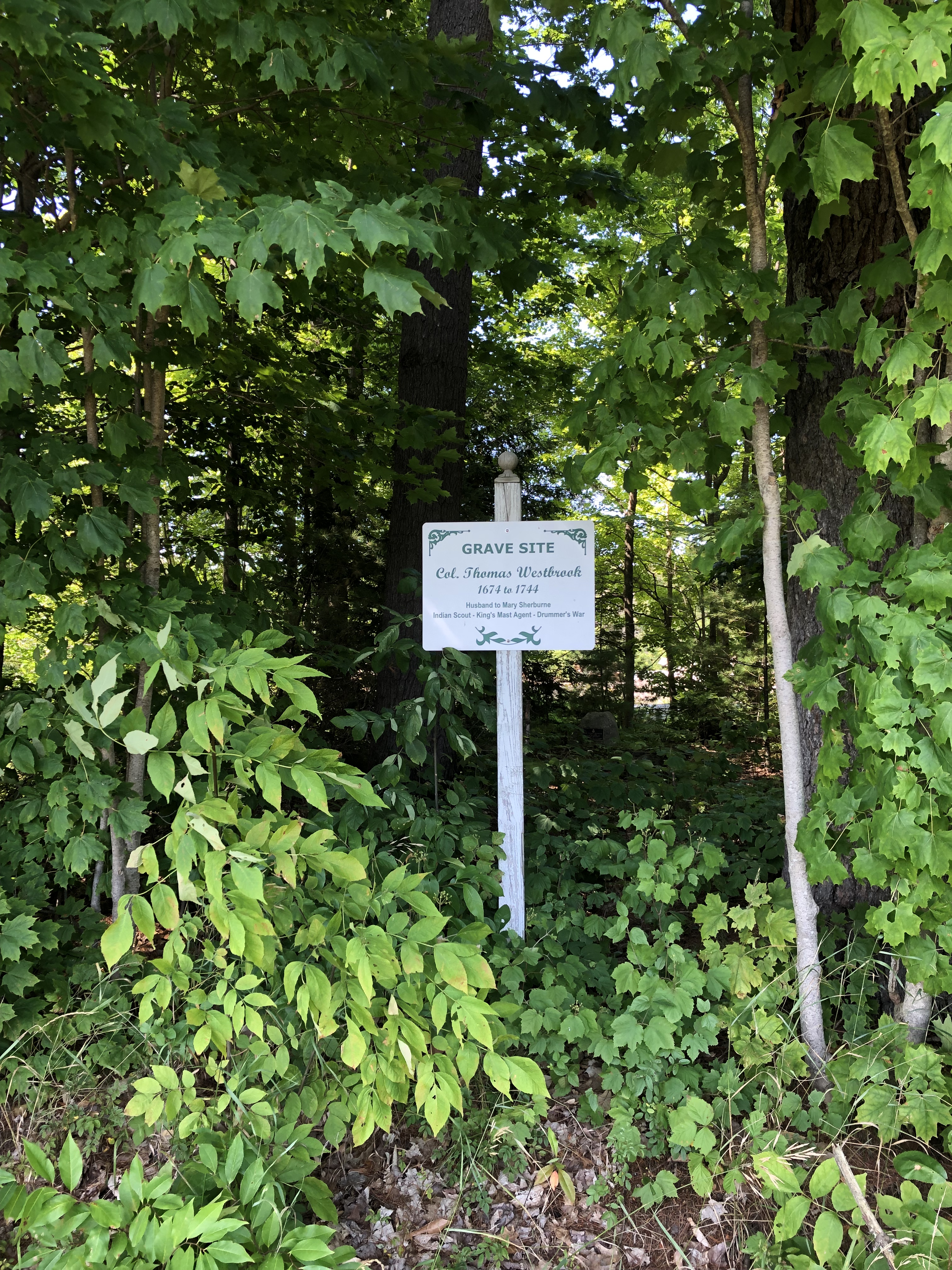
In the middle of the night 275 years ago a group of family and friends buried the old Colonel in an undisclosed location to keep his body from being dug up and used as a bargaining chip by creditors. That this war hero was in this position was regrettable, but 1744 Maine was a hardened world not prone to sentiment. The final years for Colonel Thomas Westbrook were spent in a battle with his old business partner and fellow soldier. And it was that battle that brought his family and friends out in the middle of the night to bury him, keeping the location of his grave a closely held family secret until the Bicentennial in 1976, an anniversary that settlers in 1744 couldn’t even conceive of. They were far more concerned with the very real threat of the French and Abenaki than they were about breaking from Great Britain.
It’s understandable if you have no idea who Colonel Thomas Westbrook is. Frankly I didn’t know who he was until 10:15 this morning, when I passed a sign for the Colonel Westbrook Executive Park on Thomas Drive (well played). Being in Westbrook, Maine I was curious about a man who accomplished enough in his time to warrant a town being named after him. Which brought me to discover blueberry cheesecake ice cream. But perhaps I’m getting ahead of myself.
Colonel Thomas Westbrook famously raided the Abenaki village at Norridgewock in search of Father Sebastien Rales (or Rasles, depending on whether you read the English or French description of the man). Rales led Indian raids on English settlements in Maine (then part of Massachusetts), and by 1722 the English had had enough of it. Enter Colonel Westbrook who raided Norridgewock but failed to capture Rales. He did manage to confiscate Rale’s strong box, which had incriminating evidence of coordinating with the Abenaki to raid the English settlements. This evidence became gas on the fire, igniting more hostilities between the French, English and Abenaki. In 1724 another raid on Norridgewock resulted in the massacre of 100 Abenaki and Father Rales. Westbrook wasn’t involved in that event, though his confiscation of the strong box provided plenty of motivation for those who did. This was indeed a violent time in Maine, with atrocities committed on both sides. Norridgewock was yet another example.
Searching for information on Westbrook while I waited for my lunch appointment led me to an article about the discovery of his gravesite, which led me to Smiling Hill Farm, where I asked for directions to the grave site at the ice cream stand along with what their favorite ice cream was, which led me to that blissful blueberry cheesecake ice cream, which – finally – led me to a brief visit with the Colonel. Once again I found myself off-roading in dress shoes. I should really keep some old running shoes in the car for these unplanned detours… but I digress.
The gravesite sits between a large grass field and a paved lumberyard. Colonel Westbrook was once the Royal Mast Agent supervising the harvest of white pines for the Royal Navy, so I think he’d get a kick out of the ongoing lumbering activity feet from his final resting place. He may be staring up at the planes taking off from the Portland Jetport wondering what the heck is going on in the world though. Jet engines roar over the white pines that were once the critical material for the cutting edge transportation technology of the 1700’s. Times have changed, but on the whole the place he’s buried would be familiar for him. Smiling Hill Farm remains largely as its been for generations, operated by the Knight family since 1720. They surely know a thing or two about Colonel Westbrook.
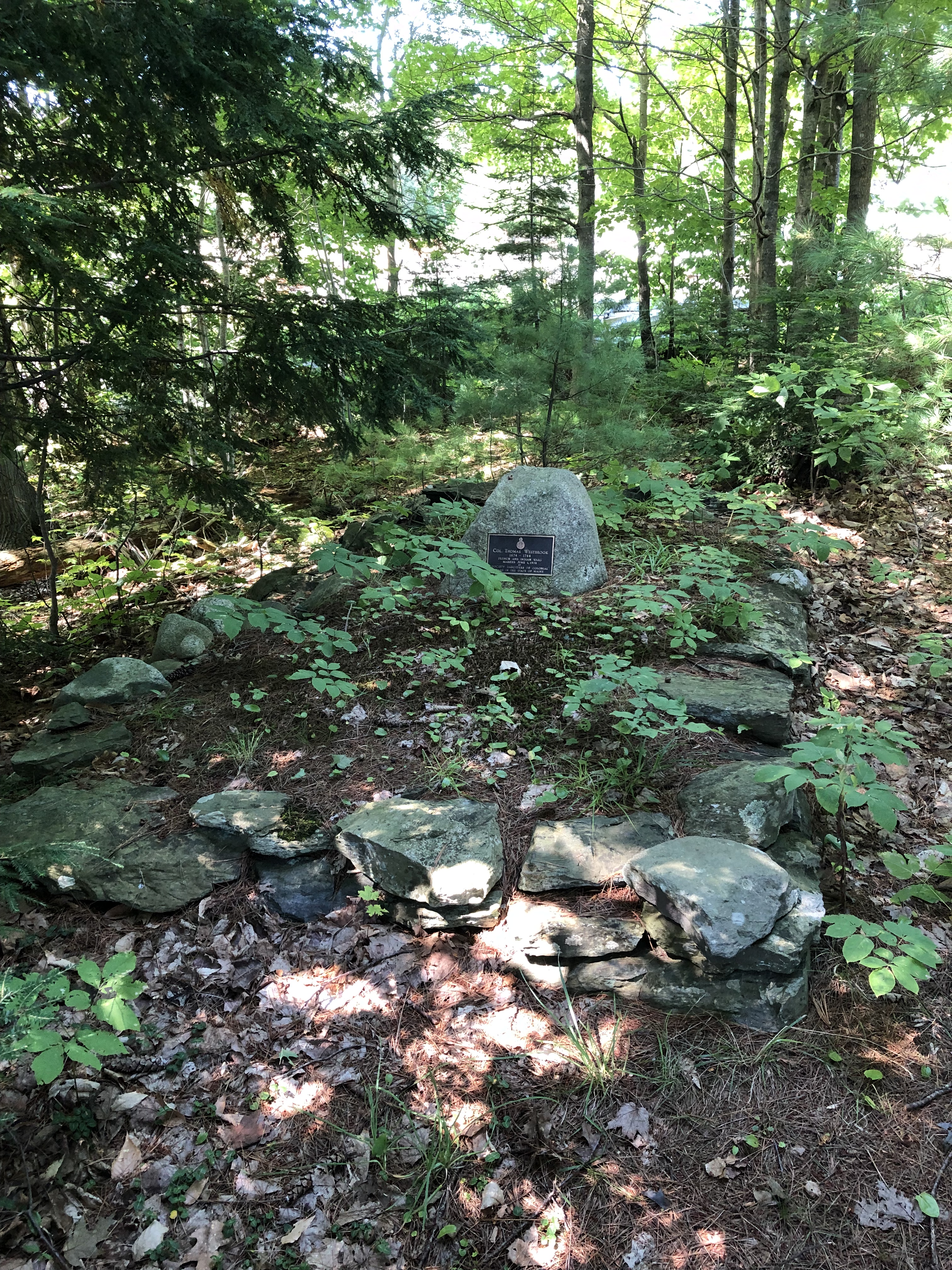
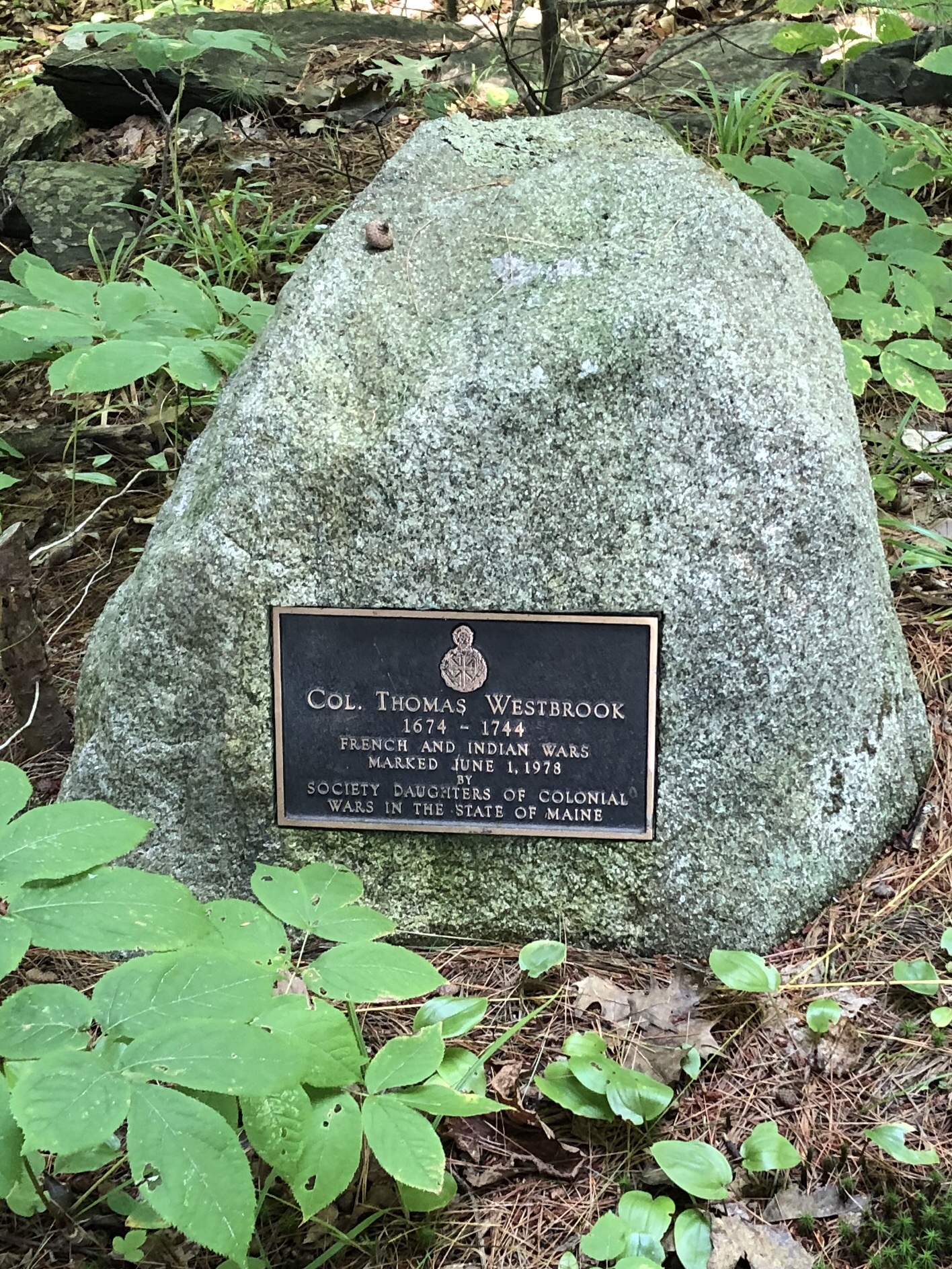
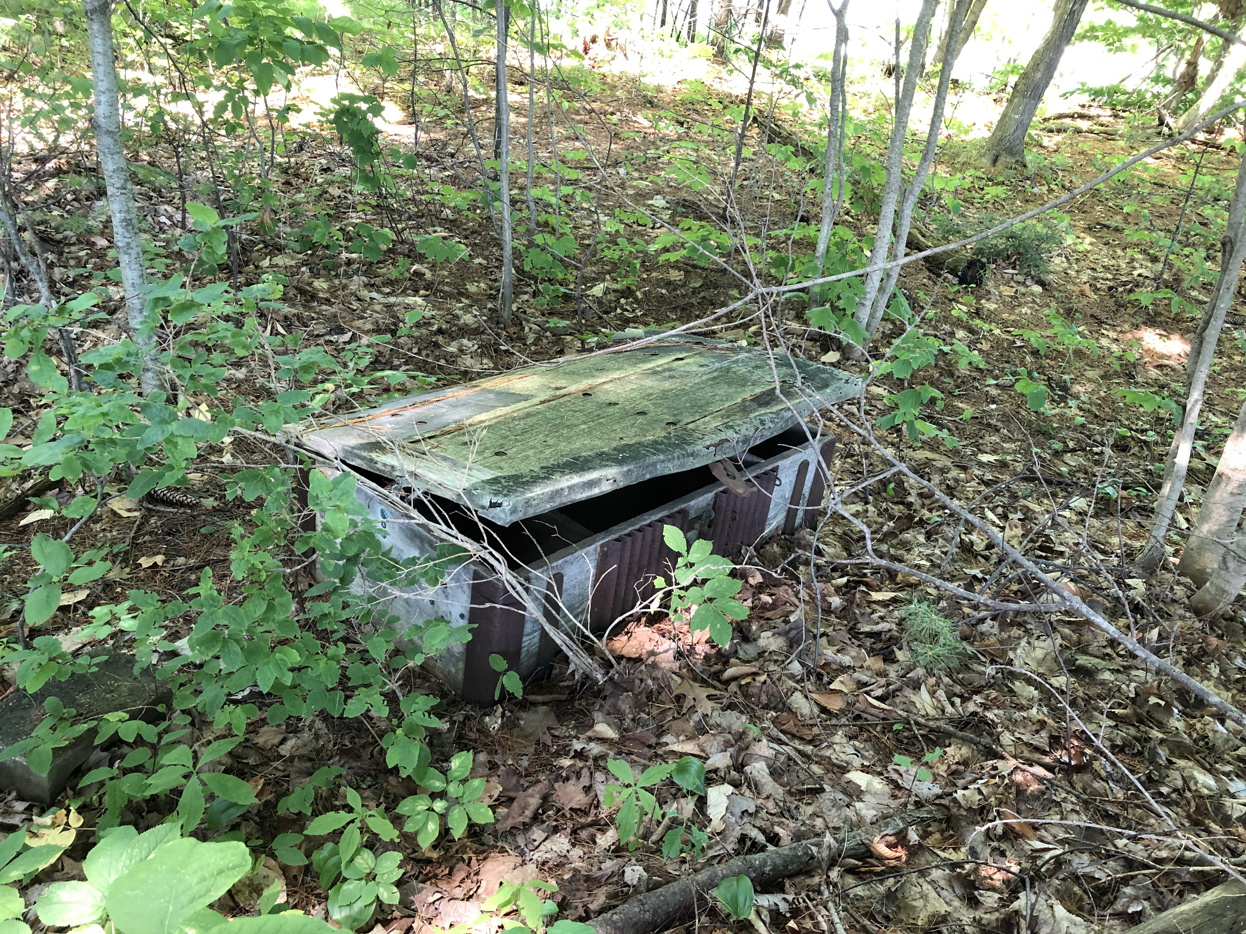
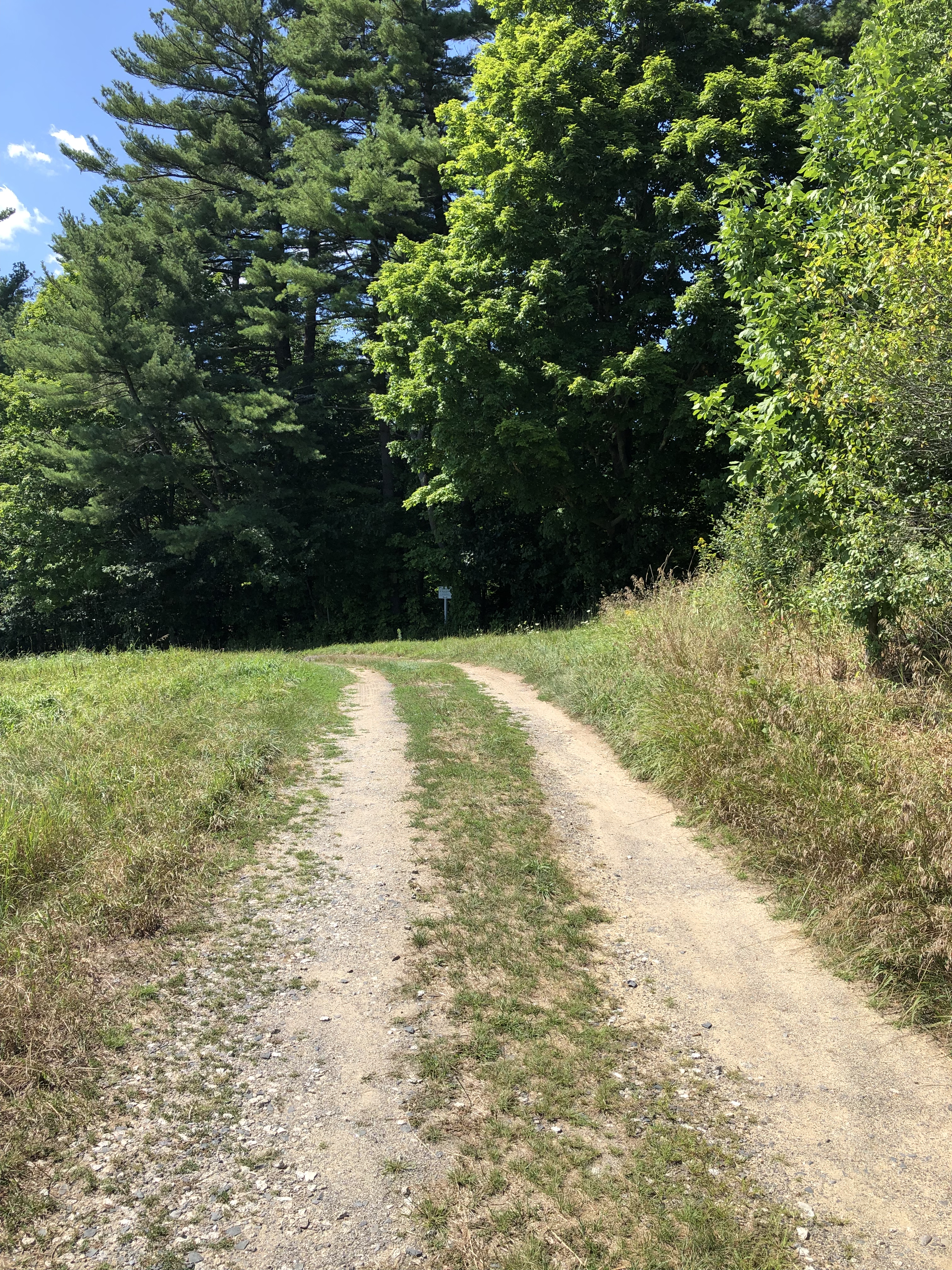
I walked the dirt and gravel road (mostly a pair of tire tracks) around the front of the lumber yard and there it was, a small white sign in front of a patch of woods marking a quiet, overgrown grave. This was the site that was revealed to the public in 1976 during the Bicentennial, making Colonel Westbrook famous throughout the area. There’s a good article that helped me greatly commemorating the 40th anniversary of that Bicentennial celebration posted in the Portland Press-Herald on August 4, 2016. Two years later it seems the Colonel has been largely forgotten again, at least judging from the overgrown condition of his gravesite. There’s a replica of Father Rale’s strong box next to the grave site, slowly returning to the earth in this shady nook.
If you go to Smiling Hill Farm, I recommend trying the blueberry cheesecake ice cream, served with a wooden spoon. Then walk a bit of it off with a five minute walk to visit the Colonel. He could use some company. I may have been the first person to visit in some time based on the path to the grave, but perhaps other history buffs have preceded me. Those that come after me will see the site in the same condition, as my footprints didn’t make much of a dent in the weeds. But I paid my respects, dress shoes and all, and got on with my day. Slightly more informed about events 275 years ago on a quiet hill in the middle of the night.