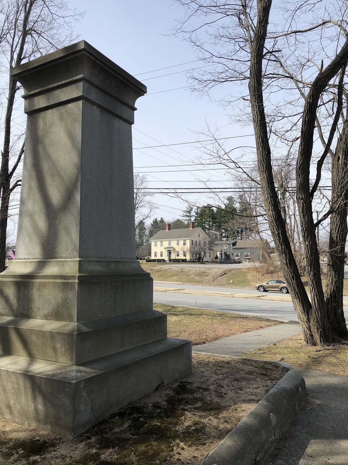
Yesterday afternoon I was in Merrimack, New Hampshire between meetings and stopped at a coffee shop for a few minutes. I passed the Common Man Restaurant, which having dined there I’d remembered as one of the oldest houses in the area. I thought I’d like to go back to the Common Man to re-acquaint myself with the house. Glancing across the street, I saw an old graveyard dated from 1742 with a tall monument with a red, white and blue wreath on it. I almost crossed the busy street to look at it but the timing wasn’t good. These are places I generally gravitate to and I made a mental note to come back to this spot sometime to get to know those who came before us a bit better.
This morning I was reading my Kindle app on my iPad and decided to clean out some old screenshots I’d accumulated when reading online articles. I came across an article on the Ulster-Scots that I’d found interesting and re-read it. One of the people in the article jumped out to me immediately; Matthew Thornton. Thornton was an Irish-born signer of the Declaration of Independence, representing New Hampshire. More interesting.
Thornton’s family arrived in Boston in 1719 with many other Ulster Scots. They moved to Wiscasset, Maine (another place I’ve come to know) but fled the area when the Abenaki attacked their settlement and burned their home. The family moved to Worcester, Massachusetts for some time before Matthew ultimately ended up in Nutfield, New Hampshire in what is now Merrimack. He served as surgeon during the French and Indian War and participated in the attack on Fort Louisbourg in Cape Breton that changed the course of that war. Thornton became the first President of the New Hampshire House of Representatives and the Associate Justice of the Superior Court of New Hampshire. In 1776 he was elected to the Continental Congress and made his way to Philadelphia, where he became one of the signers of the Declaration of Independence.
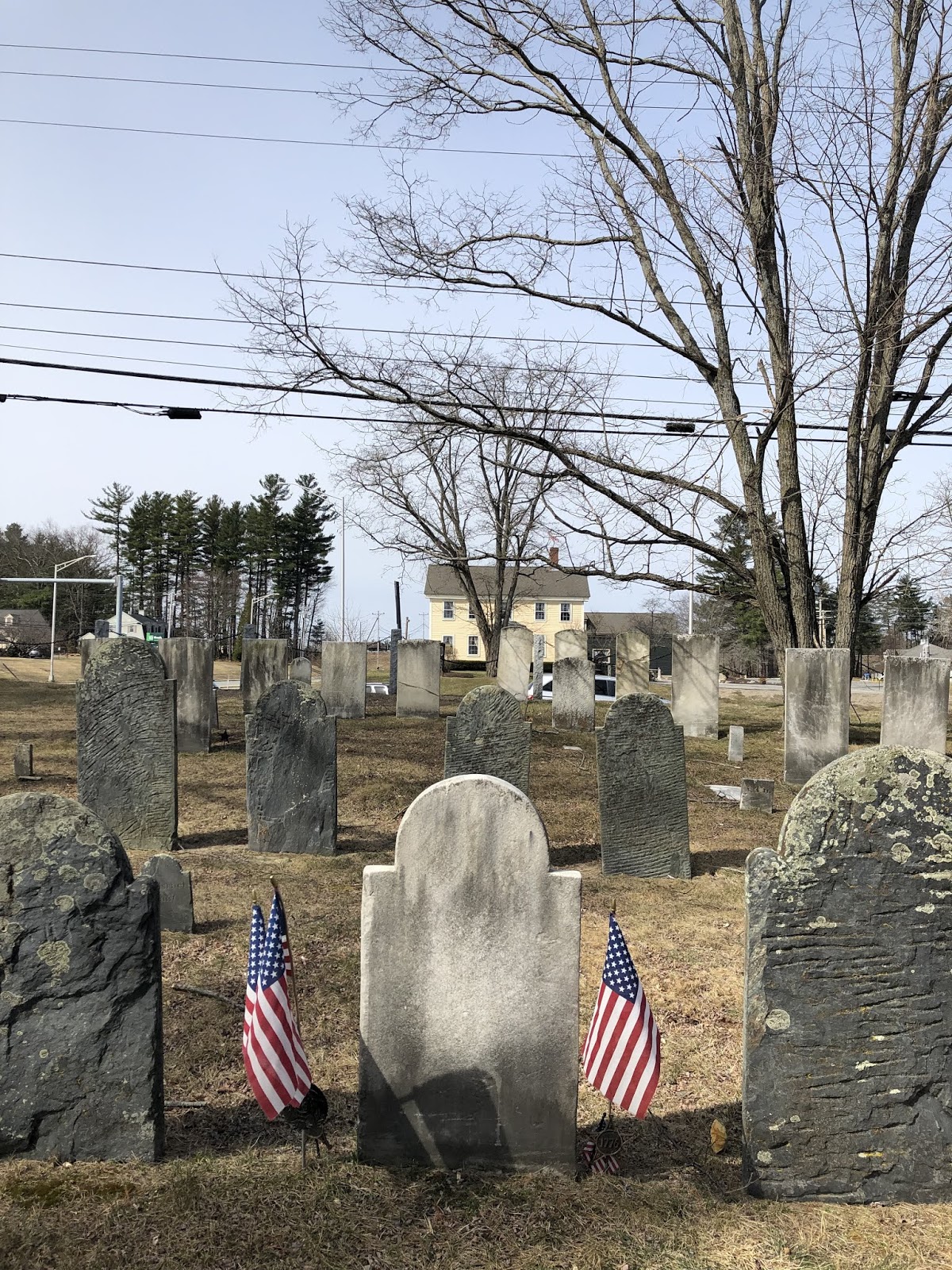
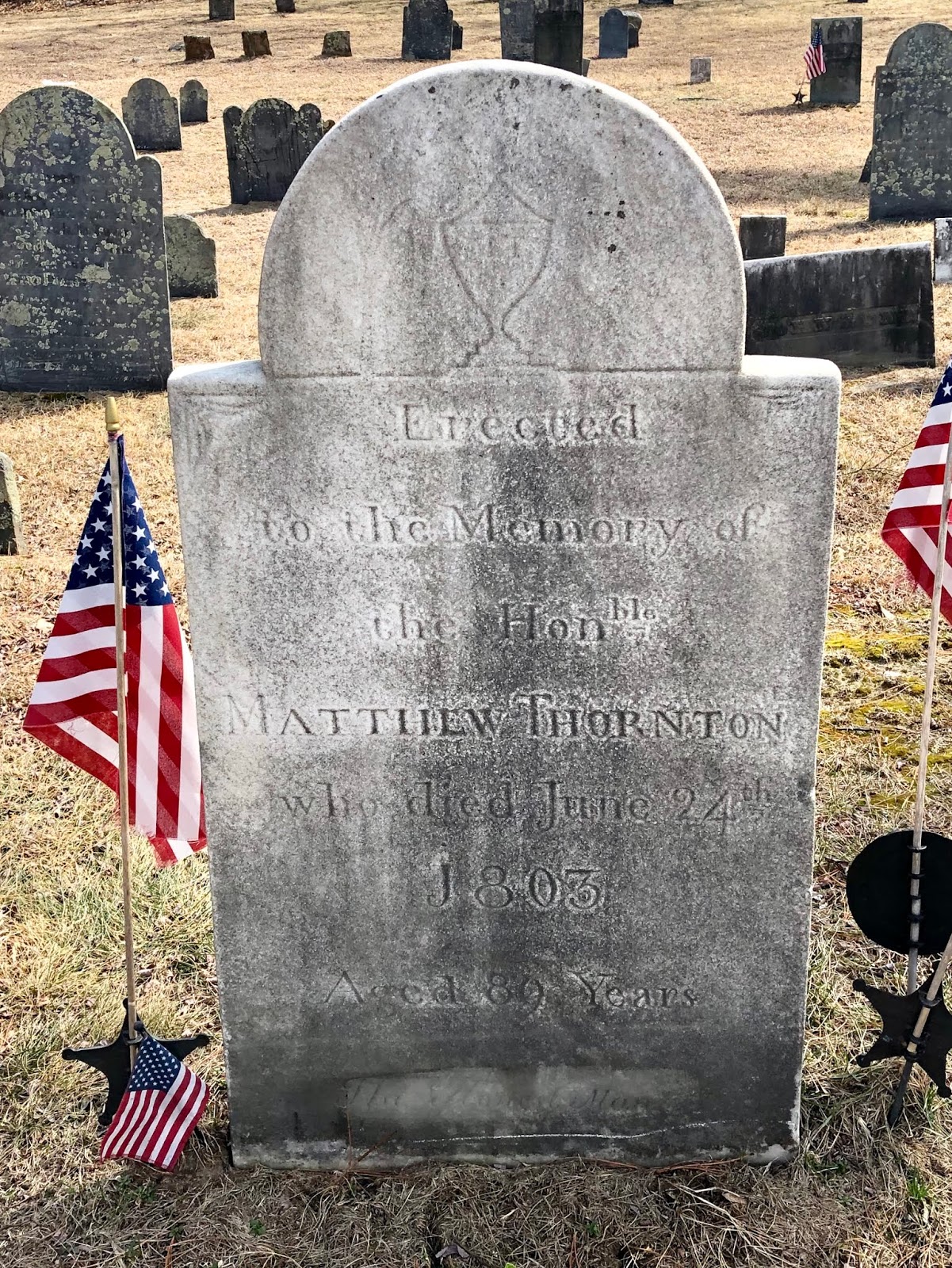
Thornton lived in the house that is now the Common Man. It’s called the Signer’s House to honor him. He died in 1803 in Newburyport, Massachusetts, but was buried across the street from his home in Merrimack, New Hampshire. That’s the graveyard that was calling out to me yesterday. So within 15 hours two random events pointed to the same man; Matthew Thornton.
Yesterday afternoon I met with a friend of mine who is living along the Souhegan River in Merrimack. I was struck by the rapids right in the backyard and commented on the Abenaki who probably had the same view, and the early settlers who came across this spot. I didn’t know at the time that Matthew Thornton probably stood roughly in the same spot several times. Once again, I’ve been dancing with ghosts…

Postscript:
Coincidently, I was driving through Merrimack again hours after I wrote this blog and decided to pull over to visit Matthew. The monument was built to honor him by the State of New Hampshire, on a lot and foundation given by the town of Merrimack, to honor Thornton. His gravestone is located roughly 50 yards away from the monument. It was carved from white marble and flanked by American flags planted in the soil on either side. His wife is buried to his left, and his sons to his right. They all face the house that they once lived in. I wonder which of them was calling to me when I drove by?